Find Out more with Fishery Using Satellite Data and Go Fishing! Vol.1: Data Summaries
I want to find fishery information using satellite data and go fishing! I've met someone who can really help me out at the Tellus Satellite Boot Camp.
The SORABATAKE editorial department has been wanting to analyze satellite data to conduct a field investigation.
Mr. Motomura, the second prize winner at the deep learning competition held at the training event on satellite data and machine learning, Tellus Satellite Boot Camp, has offered help.
He has detailed knowledge of ocean remote sensing and currently works for a maritime shipping company. With such a background, he contributed an article titled “Find Out a Fishery Using Satellite Data and Go Fishing!” This is the first volume of the entire article.
(1) I want to go sea fishing, but....
Hello, I am Kazushi Motomura. I am the kind of person who always starts fully equipped, so I looked up on fishing tackle but found it so expensive! So, before thinking about tackle, I started my focus on where to catch fish. Even though I have learned basic marine physics at university, I am a complete amateur in regard to fish or fishing. So, I was not sure where to start.
While doing research, I remembered a professional on the sea told me that fish were not scattered in the ocean but were concentrated in specific spots. In my work, I have a lot of opportunities to talk with sea professionals, so I decided to do research on fish biology and where to find fish in the ocean.
(2) Fish live around the boundary of water-masses: Learn the relationship between sea temperature and fish.
I have found some useful information on the relationship between fish and fishery.
According to this article from Yamaguchi Prefectural Institute of Public Health and Environment, fish prefer different sea temperatures at each development stage from spawning, extrication, and mature fish.
For example, Japanese Chars like 7 degrees Celsius during the spawning phase, but the suitable water temperature for matured chars is between 0.5 to 16.8 degrees Celsius.
A Research paper published by Kagoshima University says that freshwater fish can sense a change in water temperature of 0.01 to 0.05 degrees Celsius. Human beings also naturally feel a change in temperature between morning and night, but it is impossible to feel a 0.05-degree difference. This shows how much fish are sensitive to water temperature.
Will the location of a fishery be available if we just find out the water temperature? If that was the case, most of the ocean would be a fishery. So, I further studied fish biology in some more detail.
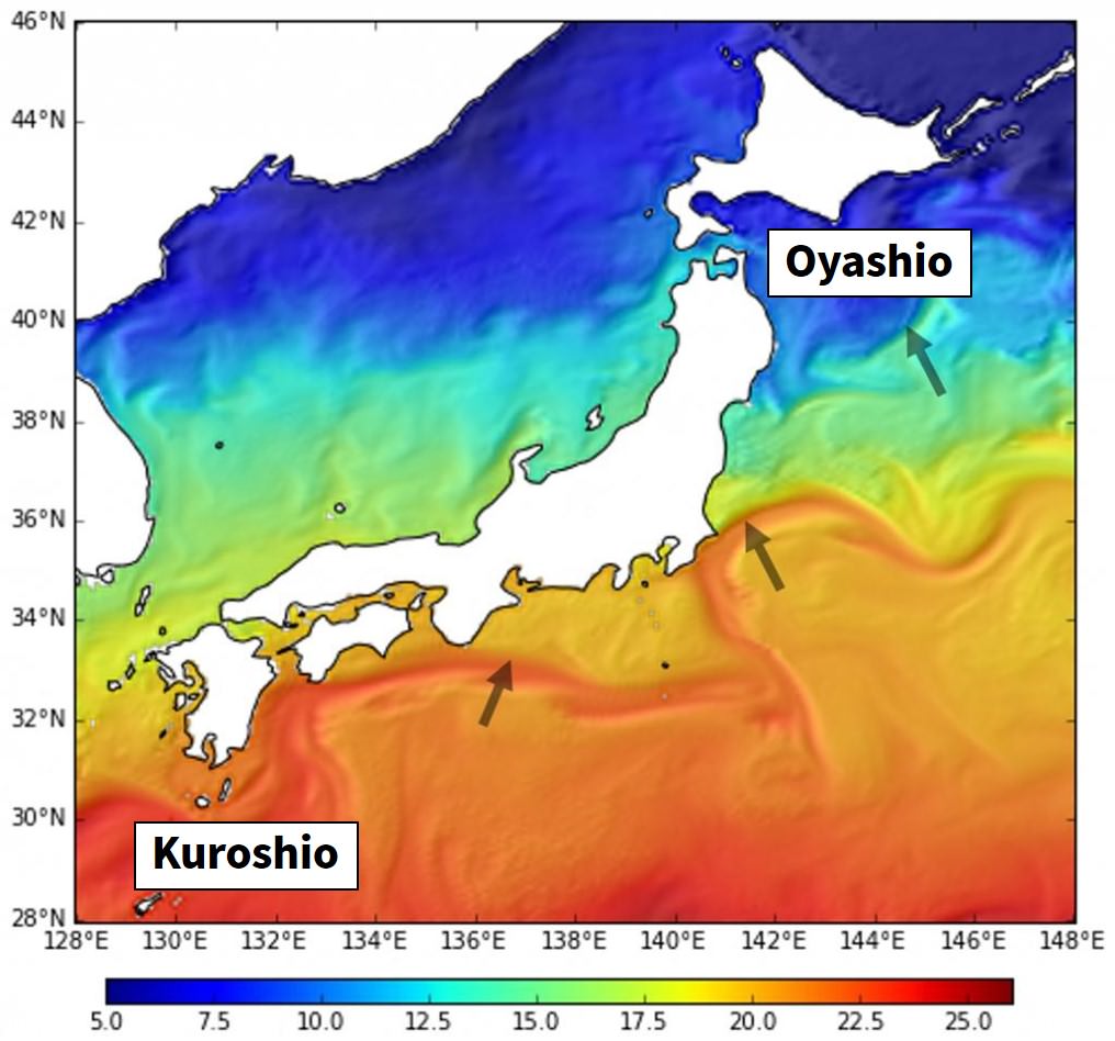
According to Kuroshio Watch run by Japan Agency for Marine-Earth Science and Technology (JAMSTEC), fish tend to be distributed around the boundary of water-masses where water temperature swings wildly. In addition, fishery prediction is often made by using an artificial satellite to find out the location of the boundary.
This boundary of water-mass is also called “oceanic front” or “current rip.” In the figure below, the arrows show the locations where water temperature changes rapidly due to the influence of warm current (Kuroshio) and cold current (Oyashio).
An acquaintance of mine in the fishery industry said that he looked at the on-board water temperature gauge and tidal current meter as often as the fish detector. As previously described, the water temperature can be observed by using satellite, but how is it different from the water temperature gauge on a vessel? The differences are summarized as follows.
Table: Differences in measuring water temperature with satellite data and gauge on the ship
| Sensor | Breadth | Resolution | Vertical observation |
| Measuring with satellite data | ○ (Extremely wide area of several kilometers) |
Several hundred meters or more | ☓ Sea surface only in general |
| Measuring with the water temperature gauge on the vessel | ☓ (Limited to the ship location) |
Pinpoint | ○ Vertical measurement of water temperature available |
A satellite can observe a broad range of areas, but its data is relatively sparse. By contrast, although a vessel can only observe a single point, it can measure the vertical water temperature, which is not possible with satellites, and therefore you can obtain data of the highest quality. But a matter of course that by vessel, you need to go out to sea for observation.
Though obtainable images are limited to quality ones on the sea surface, a satellite can be said to be a sensor that can measure water temperature without actually visiting the location. This means satellite must be a useful sensor to estimate where fish are.
Based on the above, in this project I will figure out a fishery using a satellite to observe water temperature, which plays a significant role in determining fish habitat.
(3) There are 72 satellites that can measure sea temperatures.
How many satellites are there that can measure sea temperatures?
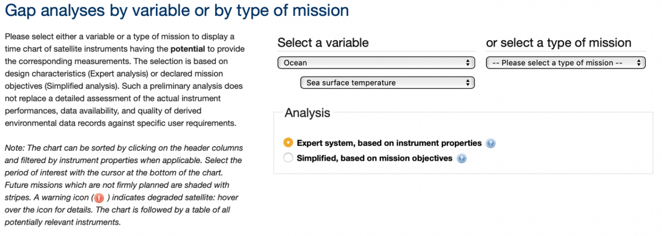
I looked at the Gap analyses by variable or by type of mission on OSCAR (Observing Systems Capability Analysis and Review Tool) provided by WMO (World Meteorological Organization).
In the “Select a variable” field, select “Ocean” as a subdomain, and then “Sea Surface Temperature” as a variable.
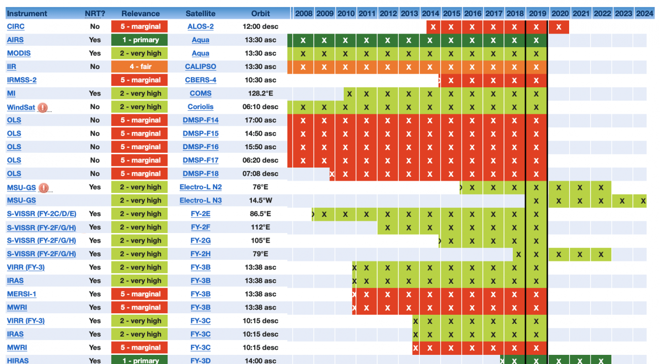
A list will be shown below on the screen. You can change the order of the list by clicking the header (e.g. Instrument, Satellite). Here I select 2019.
Gap analyses by variable or by type of mission
On this list, 72 satellites are in operation as of 2019 (A single satellite with multiple sensors is counted as one satellite). This number is much bigger than I expected.
(The number of satellites is roughly calculated to be 72 though I might need to go through the detailed examination of the list as it includes ALOS-2 CIRC) It seems that the actual number of satellites available will be slightly smaller considering the accessibility of data, etc.
These 72 satellites include Himawari, the most famous satellite in Japan. Besides the cloud images that often appear on TV, Himawari offers various data including sea surface temperature.
The spatial resolution of the sea surface temperature observed by Himawari is a little grainy at 2 km, however, it can measure at a surprisingly high frequency at every 10 minutes. Generally, the measurement of sea surface temperature by satellite is only carried out once a day. Compared to this, you can see the high frequency carried out by will Himawari.
As far as I know, the satellite data often used by fishermen are the sea surface data observed by sensors like MODIS and AMSR installed on satellites called Aqua and GCOM-W (Shizuku).
Ibaraki Fisheries Research Institute and Iwate Fisheries Technology Center uniquely disclose data on seawater temperature observed by satellite. In particular, AMSR is a sensor categorized as a microwave scanning radiometer, which, unlike the optical sensor, can measure seawater temperature under cloud at any time of day or night.
Until recently, the data on seawater temperature was obtained by optical MODIS. It could observe through the clouds, but its spatial resolution was limited to 1 km. In 2017, GCOM-C (Shikisai) was launched, and its optical sensor, SGLI, has made it possible to measure the sea surface temperature at a high spatial resolution of 250 m. Since then, we have been able to grasp seawater temperatures in more detail.
The major satellites mentioned in this article that can measure water temperature are summarized as follows.
Table: Examples of satellites with water temperature products (data)
| Satellite name | Sensor name | Sensor type | Example of spatial resolution |
| GCOM-C (Shikisai) |
SGLI | Optical sensors | 250m |
| Terra | MODIS | Optical sensors | 1km(L2) |
| Aqua | |||
| Himawari | AHI | Optical sensors | 2km |
| GCOM-W (Shizuku) |
AMSR2 | Microwave scanning radiometers | 50km |
(4) Next volume: Satellite data acquisition method
GCOM-C has just started offering the data since December 20, 2018, so I do not have much experience dealing with it yet. In the next volume, I would like to actually obtain data to see how much detail we can observe compared with existing satellite data. Using GCOM-C data, I am also going to look for a fishery near the coast where an amateur can go fish!
