Tellus releases major updates! — Tellus ver1.1 can now support JupyterLab, the R programming language with newly added data, as well as greatly improving its UI and UX!
Tellus ver1.1 was released on June 28, 2019. Tellus ver1.1 now supports JupyterLab and the R programming language. It has added 200 scenes from ASNARO-2 as well as location information data, and improved many aspects of its UI/UX with updated content!
We released ver1.1 of the satellite data platform Tellus on June 28, 2019.
Here, we will show you the new and updated features of Tellus ver1.1.
1. Top three recommended features of Tellus ver1.1
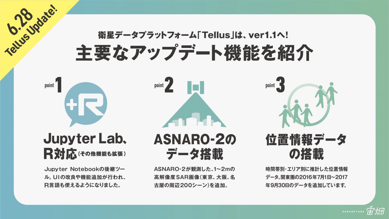
No. 1: Support for JupyterLab and the R programming language (other features have been expanded as well)
Good news for those who use the development environment (Jupyter Notebook). Tellus now supports JupyterLab!
JupyterLab is the successor to Jupyter Notebook. It has evolved into a more useful and easier to use tool with its improved UI and added features.
The R programming language as well as Python 3 are now fully supported by Tellus. In addition, the features of Tellus OS have been enhanced. See “Other updated features” for more information.
If you have already assigned a Jupyter Notebook development environment, it doesn’t automatically switch to JupyterLab. Another application is required.
No. 2: ASNARO-2 data
SAR images created by ASNARO-2 have been added (200 scenes around Tokyo, Osaka and Nagoya).
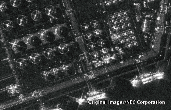
SAR images can now show landscapes of cloudy regions. See this article for more information about the SAR images.
Tellus is the only platform where you can view and analyze ASNARO-2 images as of June 2019. Enjoy ASNARO-2 images on Tellus!
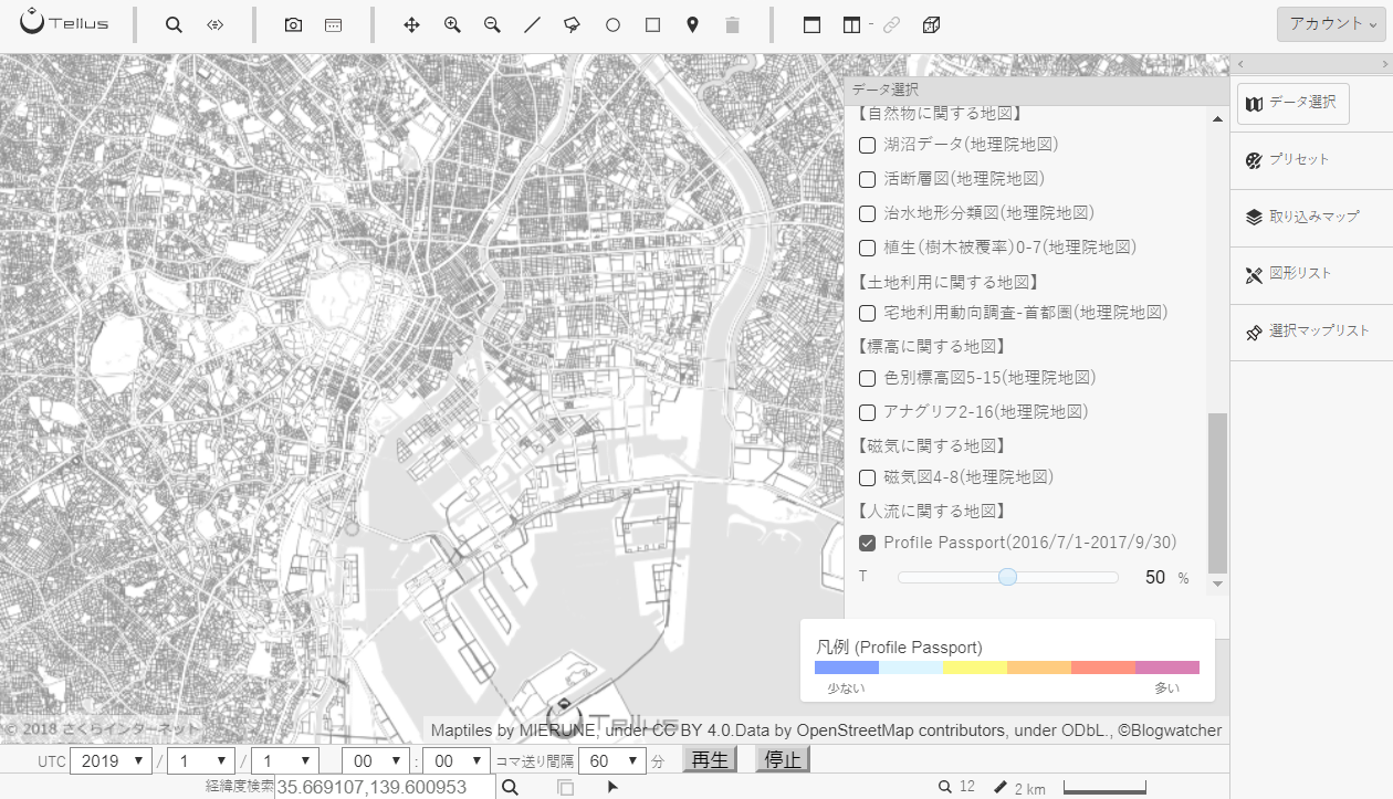
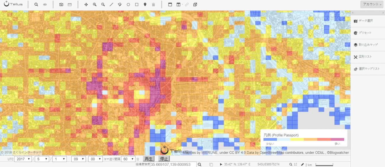
No. 3: Location information data
The location information data service “Profile Passport” is now available.
Human density of each mesh is visualized in the form of a heat map, although presently only data for Tokyo and its vicinity between July 2016 and September 2017 is available.
We will publish data for every region of Japan one by one.
2. Other updated features
Tellus ver1.1 has added and updated a lot of other features.
Tellus OS
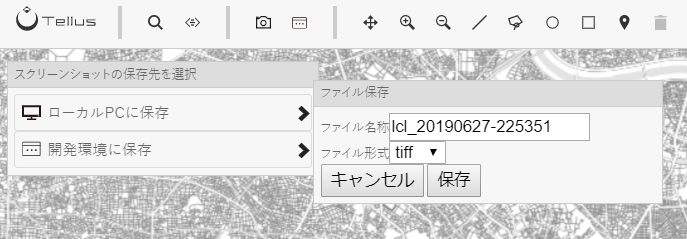
Enhanced screenshot features
- ・The destinations and names of files can now be changed.
- ・The tiff and png file formats can now be used.
- ・Screenshots can now be taken when the image is zoomed in beyond the supported level.
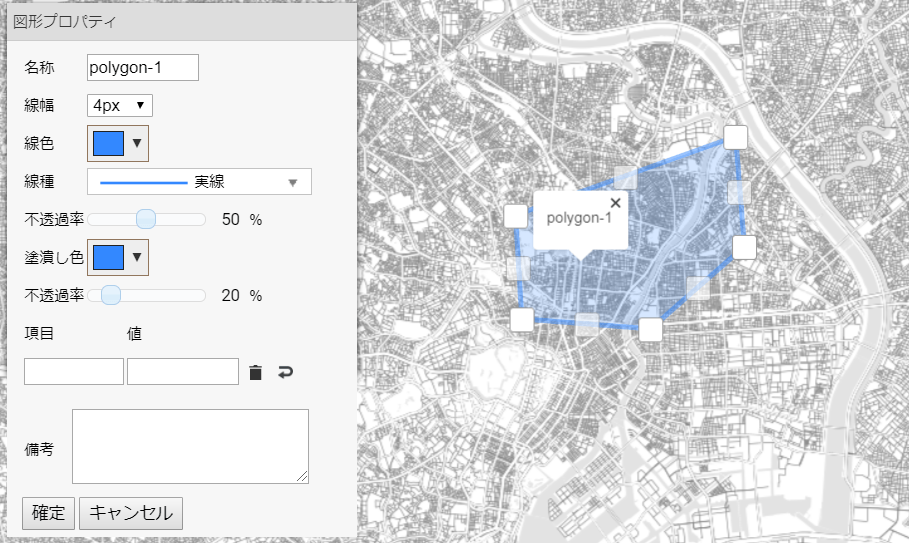
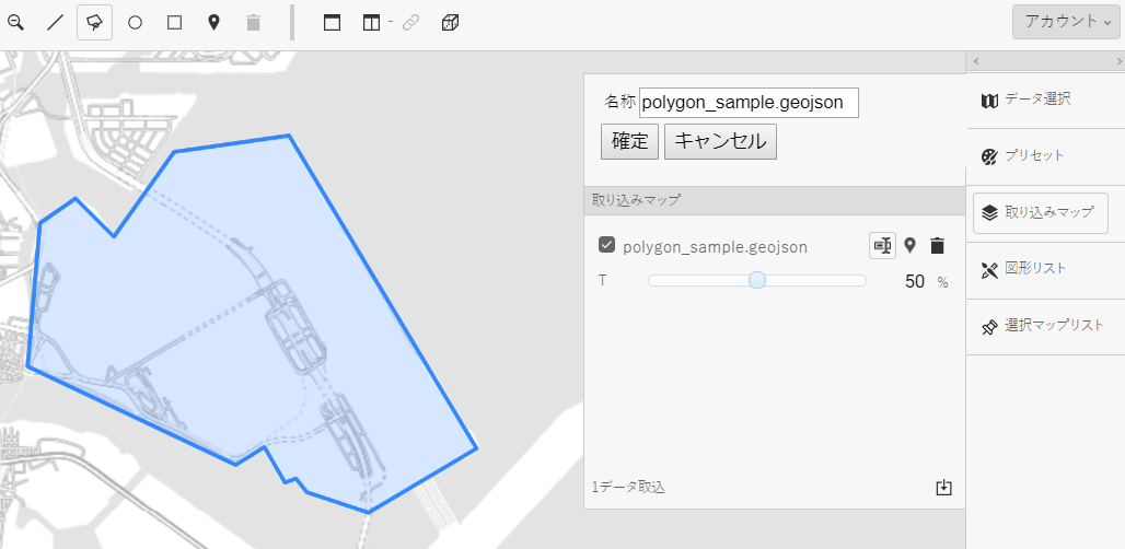
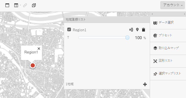
Enhanced drawing features
- ・Names of shapes can now be changed.
- ・The colors and line thickness of shapes can now be changed.
- ・The names of shapes can now be changed from the list of shapes or list of imported maps.
- ・Opacity can now be changed by swiping on a tablet or smartphone.
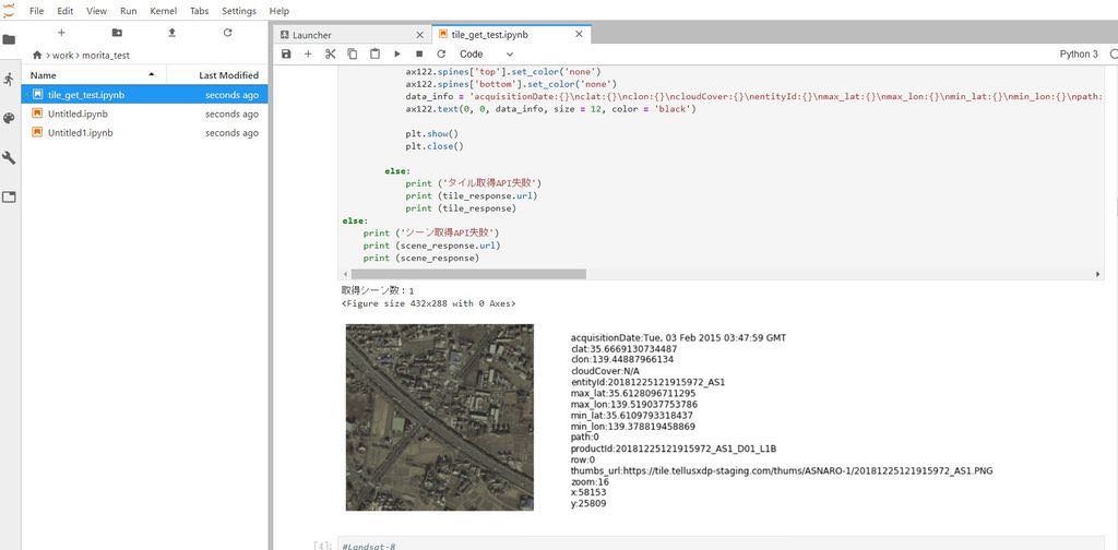
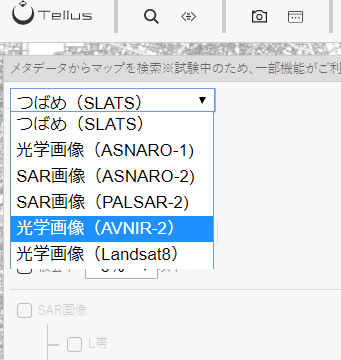
Enhanced scene search
- ・Landsat and AVNIR-2 have been added to the scene search.
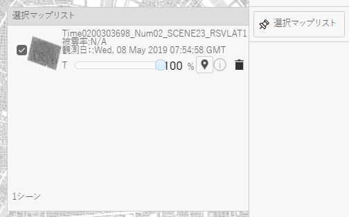
- ・”Go to this scene” feature has been added to the 選択マップリスト (Selected map list).
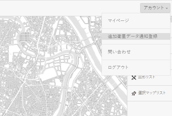
New feature to notify users of additional data within registered areas
- ・By registering areas you are interested in, you can get email notifications of data additions within the areas.
Improved UI
- ・The legend is displayed in the colored elevation map, precipitation map, daytime and night-time temperature map and Profile Passport.
- ・When the location search window is opened, the input field gets the focus.
- ・When the location search window is opened, the input field gets the focus.
Satellite data
- ・200 scenes around Tokyo, Osaka and the Chukyo region from the ASNARO-2 data have been published.
- ・APIs that can call images of each single band of ASNARO-1 and Landsat-8 have been published.
Ground data
RESAS data can now be viewed from the development environment.
This time, agricultural data below has been published.
- ・Agricultural output by municipality
- ・Agricultural output by prefecture
- ・Agricultural output in Japan
- ・Agriculture-related activities by municipality
- ・Agriculture-related activities by prefecture
- ・Agriculture-related activities in Japan
- ・Agricultural population by municipality
- ・Agricultural population by prefecture
- ・Agricultural population in Japan
- ・Farmland area by municipality
- ・Farmland area by prefecture
- ・Farmland area in Japan
- ・Agricultural sales by municipality
- ・Agricultural sales by prefecture
- ・Agricultural sales in Japan
- ・Rates of change in agricultural sales by municipality
- ・Rates of change in agricultural sales by prefecture
- ・Rates of change in agricultural sales in Japan
We will also publish data in other areas one by one. Please wait for a while.

These are the main points of Tellus ver1.1.’s updated features
When we released the update, we also added an “improvement request form” on the service. Please feel free to let us know if you are not satisfied with Tellus or you have trouble with it so that we can offer you a better service.
With the motto of “Create easy-to-use, enjoyable and useful stuff together,” the satellite data platform “Tellus” keeps evolving. We hope you will like it.
