What you can do on Japan’s First Satellite Data Platform “Tellus”
Japan’s First Satellite Data Platform “Tellus” has been launched on February 21st, 2019.
Japan’s First Satellite Data Platform “Tellus” has been launched on February 21st, 2019.
Today, we are living in a data driven society with all kinds of data, including personal SNS posts on Twitter and Instagram, to marketing trends of all countries throughout time.
This article introduces possibilities of satellite data in our massive data society and the highlights of Tellus.
(1)Satellite data, a leading example of macro data, which will change the world
Why does satellite data gain such attention in a big data society?
Generally speaking, big data deals in micro data such as people’s movement (people’s flow data), output of individual devices, and SNS posts.
On the other hand, satellite data is said to be that of macro data, so mass information from the ground can be obtained periodically.
For example, the satellite obtains increases and decreases in numbers of vehicles in parking lots of Walmart (shopping mall) across the United States (macro data), and then Walmart combines it with their sales report that becomes available in each period.
By analyzing the correlation between the two sets of data, the potential sales in the next period can be predicted from new satellite data. Investors use this information to estimate the share price.
This example shows the applied possibility for marketing and streamlining, and different industries keep a watchful eye on the combination of ground and satellite data.
(2)Challenges in analyzing the existing satellite data
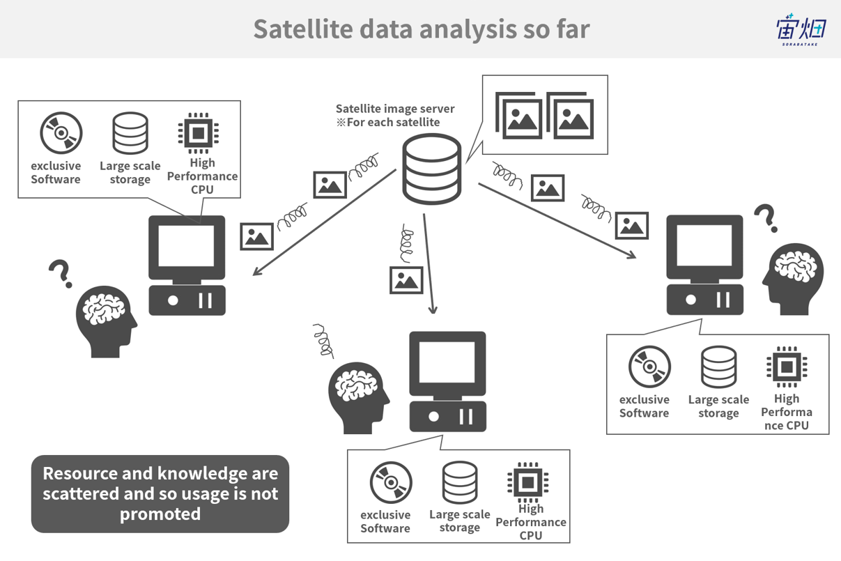
Satellite images were used to be downloaded from each of the satellite database and analyzed with a dedicated software in a special calculation environment (PCs) prepared by each user.
Since satellite data is large, it takes time to download it to a local environment.
In addition, each user conducted analysis in their individual environments, making the resources and knowledge scattered and even lost. As a result, satellite data failed to expand its use.
Organizing an infrastructure that can provide a consistent service from data distribution to its analysis, the Satellite Data Platform Tellus has been launched to lower the entry barriers to satellite data utilization as much as possible.
(3)What can you do on Japan’s First Satellite Data Platform “Tellus”?
Tellus offers a variety of tools to combine satellite and ground data for business opportunities.
-Have a look at satellite data: Tellus data Operation System (Tellus OS)
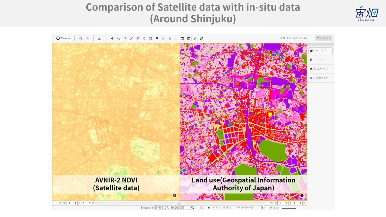
On Tellus OS, you can see the combined data by uploading the data you have and selecting the satellite or ground data on Tellus according to your objectives.
By looking at combined data and comparing it from different perspectives such as time sequence and area, you can understand the difference between before and after an event or even send screen data to the development environment, as will be described later.
Click here for the specific work procedure on Tellus OS
-Quick satellite data analysis in the integrated development environment (Jupyter Notebook)
-Quick satellite data analysis in the integrated development environment (Jupyter Notebook)
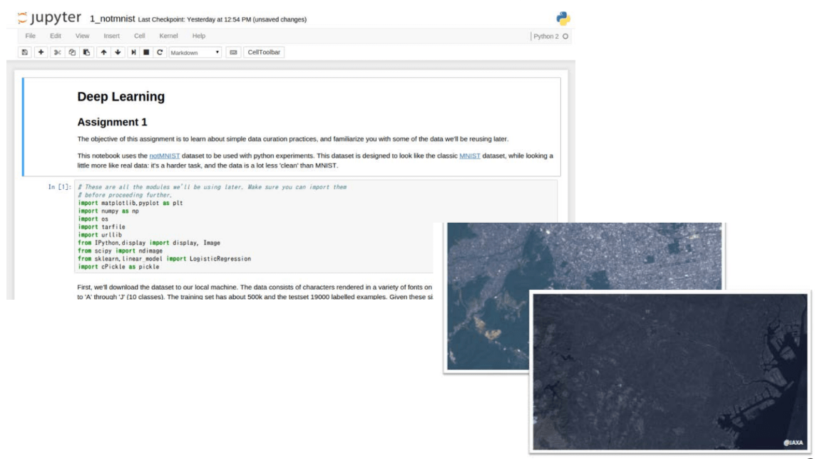
This is especially for people who do not know where to begin regarding satellite data analysis.
You can easily start satellite data analysis by using the integrated development environment (Jupyter Notebook) on cloud prepared by Tellus in advance.
Click here for specific work procedures for the integrated development environment
-Satellite data analysis in your original development environment
We also provide computing resources for those who would like to analyze data deeply in your own development environment.
By building your original development environment,
you can have better opportunities to expand your business by batch processing that enables importing satellite data at regular intervals instead of a one-time analysis and show the results on a website.
(4)Data to be added and the frequency of updates (including data shown for the first time in the world)
Various data will be loaded on Tellus.
Please refer to the Tellus data catalog for more details.
●Satellite data loaded on an open and free platform for the first time in the world’s history.
The most notable ones are “PALSAR-2” and “ASNARO-1”. They are both satellite images that have not been released for free. To begin with, please open Tellus OS and just take a look at the images.
“PALSAR-2” is a SAR sensor equipped in ALOS-2 developed by JAXA. It is a sensor that can take pictures at night or in areas covered with cloud.
“ASNARO-1” is a high-resolution (0.5m) optical image. It is the first time ever that such high-resolution satellite images are provided on a free platform.
●”Flow of the people” and “meteorological data” are the keys to ground data
Satellite data is not the only data to be loaded on Tellus.
This update covers “people’s flow data” gained by analyzing the flow of the people based on their mobile phones and “meteorological data” collected based on meteorological information on the ground.
(5)Comparison with preceding examples in other countries
The feature of Tellus is that various softwares, environments, and data can be used for free and for commercial purposes (additional agreement is required).
There are satellite data platforms in other countries including AWS and Copernicus DIAS.
They are based in the United States and Europe respectively and offer services globally, but Tellus is the world’s first platform that focuses on Japan and the Asian region.
(6)The future of Tellus
Tellus is planning to organize a market where data application algorithms can be shared amongst users on the same platform.
We will encourage creating innovations and new businesses by involving as many engineers, data scientists, and business people as possible to use data for free and at low risk.