Basics of Synthetic Aperture Radar (SAR) – Examples, Understanding, Sensors, Satellites, and Wavelengths
Among the booming space startups, one technology that has garnered significant attention is "Synthetic Aperture Radar," abbreviated as SAR. In this article, we will introduce SAR, which has rapidly gained prominence in recent years, and explore its applications and future possibilities.
Among the booming space startups, one technology that has attracted exceptional attention is “Synthetic Aperture Radar” (SAR). SAR is a technology that allows observation of the Earth’s surface from space even when much of it is covered by clouds, which is not feasible with optical cameras.
However, due to the technical challenges in miniaturization and cost reduction of SAR sensors, they have had very limited use in satellite business until recently.
In this article, we will introduce SAR, which has rapidly gained prominence in recent years, and explore its applications and future possibilities.
This article was originally published in 2019 and has been updated with additional related content in March 2023.
(1) Use cases of SAR
Let’s explore some examples of how SAR technology is being utilized:
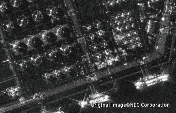
(i) Monitoring Oil Tanks
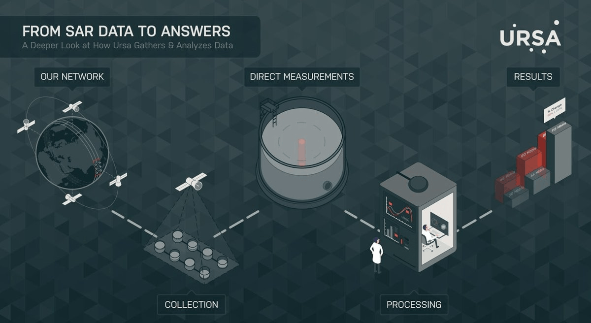
The company Ursa Space Systems uses SAR sensors to monitor oil tanks worldwide and provides information for futures trading. Inside oil tanks, the ceiling lid moves up and down in accordance with the quantity of oil, preventing oxidation. By observing the height of each oil tank’s lid with SAR sensors, it becomes possible to estimate the amount of oil stored in the area.
Continuous monitoring allows identifying trends, such as whether the oil storage has increased or decreased compared to the previous year.
While similar observations are conducted with optical images, like those taken by digital cameras, optical imaging cannot capture images when clouds cover the area. SAR sensors can penetrate clouds, enabling regular observations regardless of weather conditions.
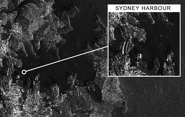
(ii) Ship Surveillance
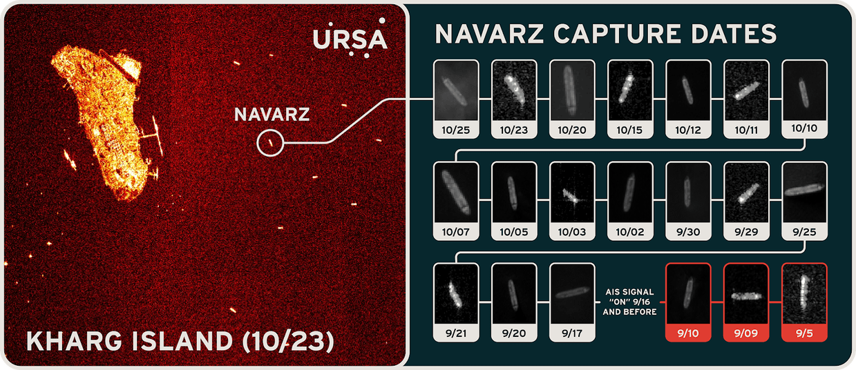
Another characteristic of SAR sensors is their ability to easily detect artificial structures on water surfaces, making ships at sea highly visible.
Presently, large ships are required to use a device called AIS to transmit and report their positions and speeds. However, some illegal vessels operate without making such reports.
By comparing the ship’s location data obtained from SAR sensors with the information reported by AIS, it becomes possible to identify vessels that are present at a location but not making any reports – indicating potential illegal activity.
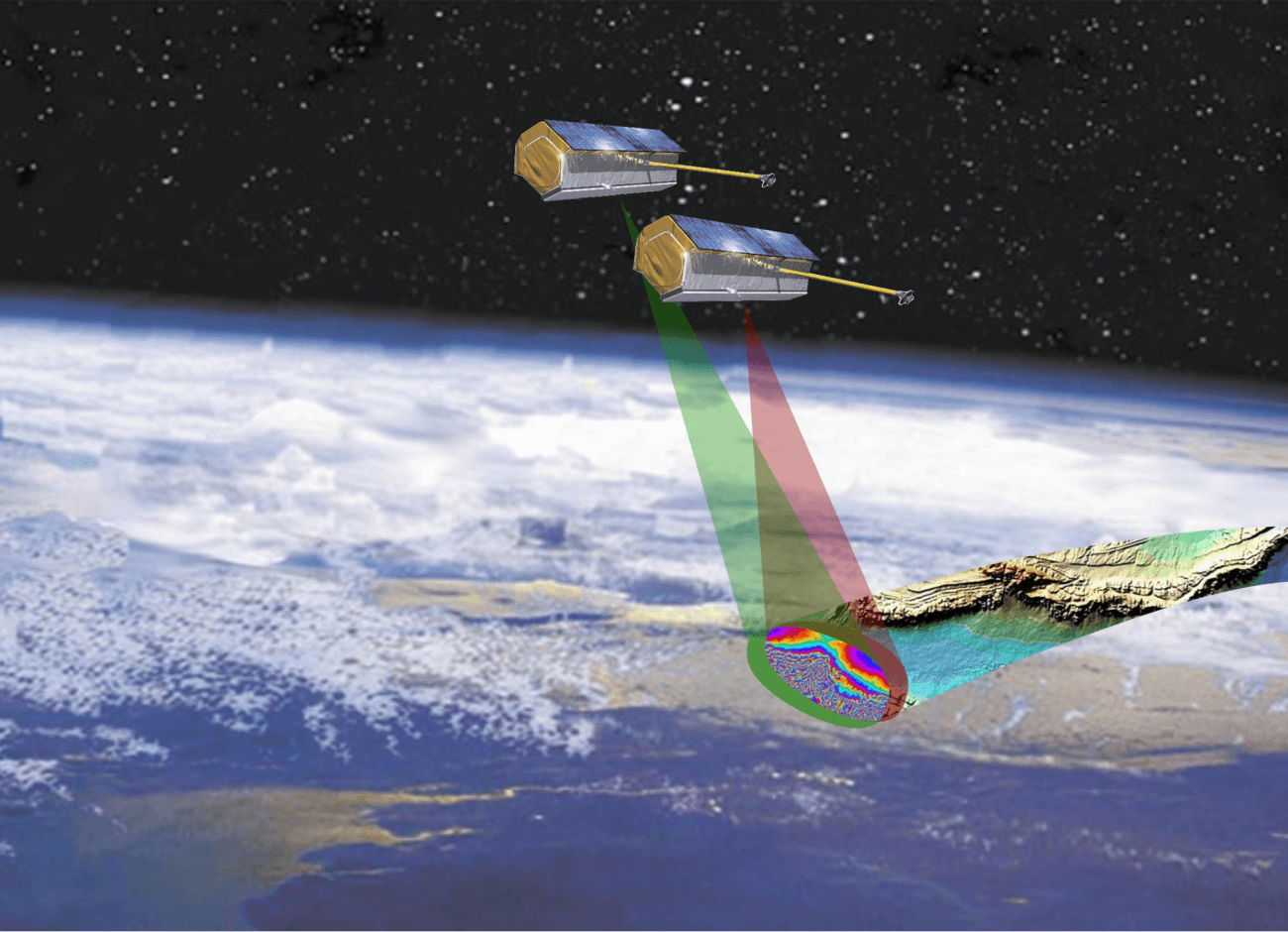
(iii) Land Subsidence
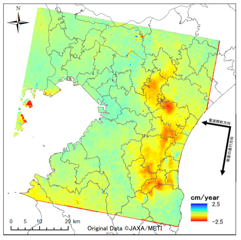
A widely discussed application of SAR sensors is the use of “interferometric SAR” technology. This technology allows detecting ground subsidence or uplift with centimeter-level accuracy.
In the figure above, the red-colored area indicates a subsidence of about 2 centimeters. Such information can be utilized to implement measures for tunnels, roads, buildings, and other structures.
(iv) Deforestation Monitoring
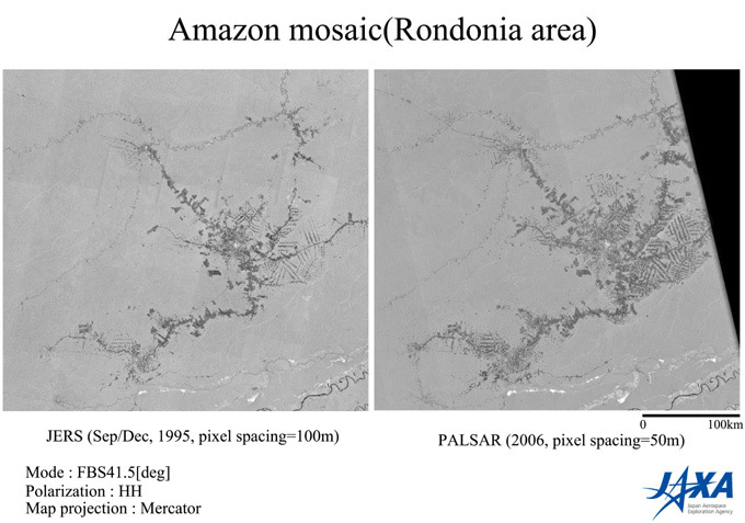
SAR sensors can also observe forests.
The images above show SAR sensor images of the Amazon rainforest captured at different times. Comparing the image from 1995 (left) with that of 2006 (right), you can see the deforested areas resembling fish bones.
These observations can be used to monitor illegal deforestation and assess damages after forest fires. Governments of various countries are using SAR sensors for various strategies, and recently, private enterprises have also taken initiatives, such as forest certification systems and insurance programs.
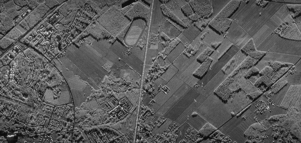
(2) SAR (Synthetic Aperture Radar) Sensor
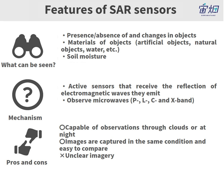
SAR stands for “Synthetic Aperture Radar.” Radar is a sensor that emits microwaves (a type of radio waves) and captures the microwaves that bounce back from the Earth’s surface. “Synthetic aperture” refers to a technique that improves the sensor’s performance by combining the results of the microwaves that have bounced back from the surface.
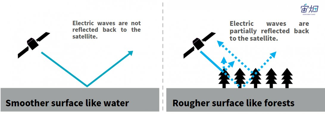
In SAR images, rough surfaces reflect more microwaves, appearing as brighter areas, while smooth surfaces, like water bodies, reflect fewer microwaves, appearing darker.
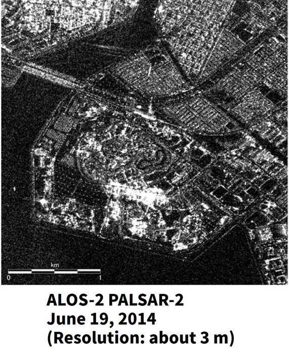
Due to the sensor’s principle, SAR images are not as smooth as optical images, and they exhibit a granular appearance similar to the grainy images from an ultrasound used in prenatal examinations.
Credit : JAXA
(a) Differences between Optical Images and SAR Images, Strengths, and Weaknesses of SAR Sensor
Credit : sorabatake
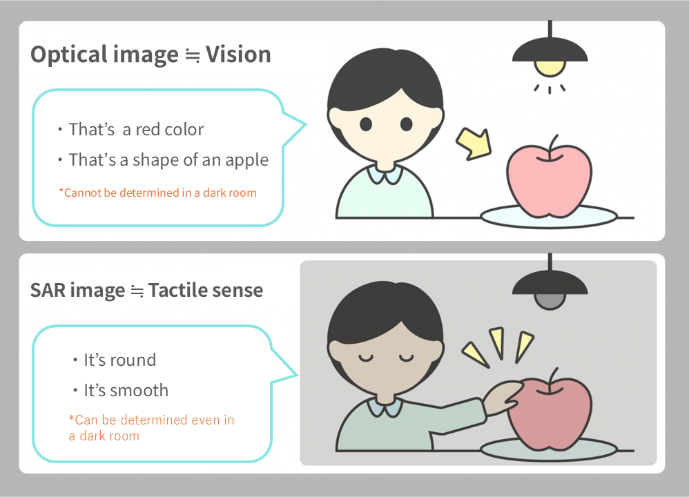
The difference between normal images (technically referred to as “optical images”) and SAR images can be likened to the difference between visual and tactile information.
Optical images allow us to perceive the color, shape, and identify objects visually, but they require sufficient illumination to be visible. Optical images are well-suited for recognizing object colors, shapes, and identifying the objects themselves. However, they become ineffective at night or when obscured by clouds, as nothing can be seen in such conditions.
On the other hand, SAR images can be likened to tactile information. It’s similar to a game where participants are blindfolded and need to identify objects inside a box by touch. SAR images provide information similar to the sense of touch. They allow us to distinguish between smooth and rough surfaces and understand the shape of objects. However, knowing the actual identity of the objects requires the person touching them to rely on their prior experiences.
One of the distinctive features of SAR images is that they can be captured under consistent conditions since they observe the reflection of self-emitted microwaves. This makes SAR images adept at detecting changes by comparing “Before” and “After” images, unlike optical sensors, which are influenced by sunlight conditions.
As microwaves can pass through clouds, SAR can conduct surface observations even in cloudy areas. Additionally, as it actively emits microwaves, SAR can conduct observations day and night, irrespective of sunlight conditions.
(3) Capabilities of SAR Images
(a) Differences in Frequencies
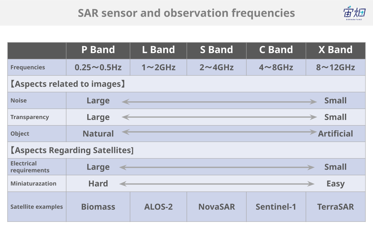
Similar to optical sensors, SAR sensors operate at different observation frequencies. The commonly used frequencies are L-band (1-2 GHz), C-band (4-8 GHz), and X-band (8-12 GHz), with shorter wavelengths in that order. The differences in frequencies result in different reflections and returns from various objects.
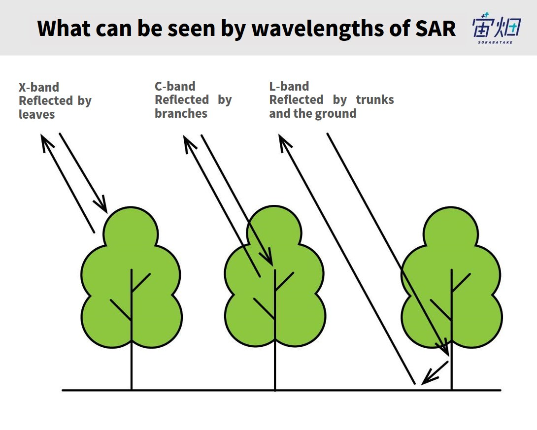
The longest frequency, L-band, can penetrate through leaves, branches, and grass, making it suitable for observing objects close to the ground, such as tree trunks or the Earth’s surface. It is well-suited for monitoring large-scale crustal movements. In the C-band, microwaves are reflected by branches. The shortest X-band reflects off leaves and grass, making it ideal for observing finer details compared to L-band and C-band.
(b) Differential Comparison
Credit : sorabatake
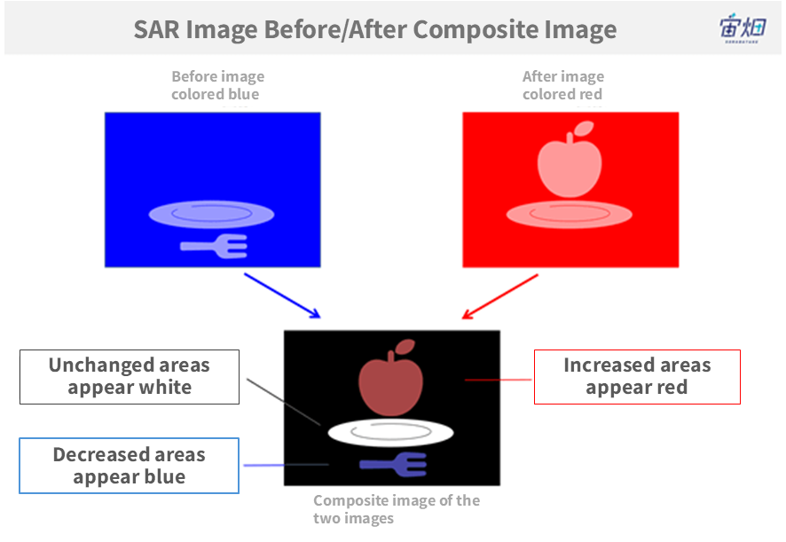
This illustration demonstrates the principle of comparing SAR images before and after.
By coloring the previous image in blue and the subsequent image in red and combining them, elements that were present in only one of the images are highlighted with color.
In this example, apples are represented in “red” in the composite image because they appeared in the after-image but not in the before-image, indicating an increase. On the other hand, the fork, which was present in the before-image but not in the after-image, appears in “blue” in the composite image. The plate, which was present in both images, appears in “white” in the composite image. Areas with no features in either image (no microwave reflection) appear in “black.”
By colouring and combining two images captured at different times, it becomes possible to discern changes that occurred during that period.
(c) Polarization
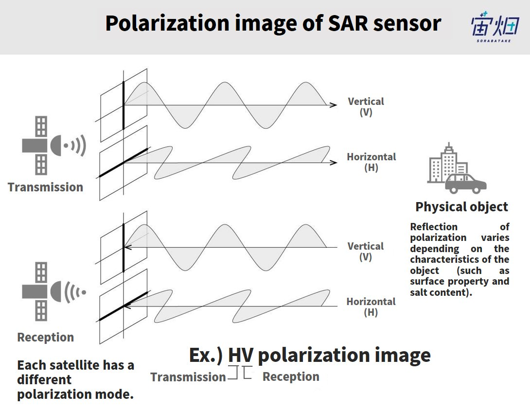
Additionally, SAR satellites have a polarization function. The polarization of SAR sensors divides the microwave into two orientations: horizontal (H) polarization and vertical (V) polarization, as shown in the figure.
SAR emits horizontal (H) or vertical (V) polarization and receives reflected microwaves in either horizontal (H) or vertical (V) polarization.
When SAR emits microwaves horizontally and receives them horizontally, it is labeled HH; receiving them vertically is labeled HV. Emitting microwaves vertically and receiving them vertically is labeled VV, while receiving them horizontally is labeled VH. Some larger satellites can receive both horizontal and vertical polarizations simultaneously and are denoted as HH-HV.
Polarization is used for object identification. Depending on the characteristics of objects (such as surface properties or salt content), microwaves are reflected differently, resulting in variations in the strength of reflections in the images.
Using polarization, it becomes possible to distinguish urban areas with many buildings from forests, for example.
In areas with mostly flat surfaces, like buildings, the waves return with minimal changes in orientation, resulting in higher signals for HH/VV and lower signals for HV/VH.
In contrast, in areas with rough surfaces, like forests, the waves scatter more chaotically, resulting in weaker HH/VV signals and relatively stronger HV/VH signals.
Additionally, it is possible to analyze the age of sea ice based on differences in salt concentration.
(d) Interferometric SAR (InSAR)
As mentioned earlier, the ability to detect ground subsidence is achieved through “Interferometric SAR” (InSAR).
You may recall the phenomenon of “Newton’s Rings” from your middle school physics classes.
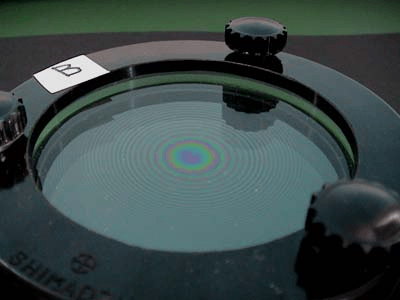
Credit : Kumiko Nakata, Graduation Research (In Nakamura Lab), 2001
When light passes through two different materials with slightly different thicknesses, the waves slightly shift and create an “interference” phenomenon, producing rainbow-colored rings.
In the case of InSAR, the microwaves observed during normal conditions and those observed after ground subsidence will experience a slight phase shift. By artificially “interfering” these two waves, the InSAR technique allows us to determine whether ground subsidence has occurred, to what extent, and whether there has been any change.
(e) SAR Sharpening
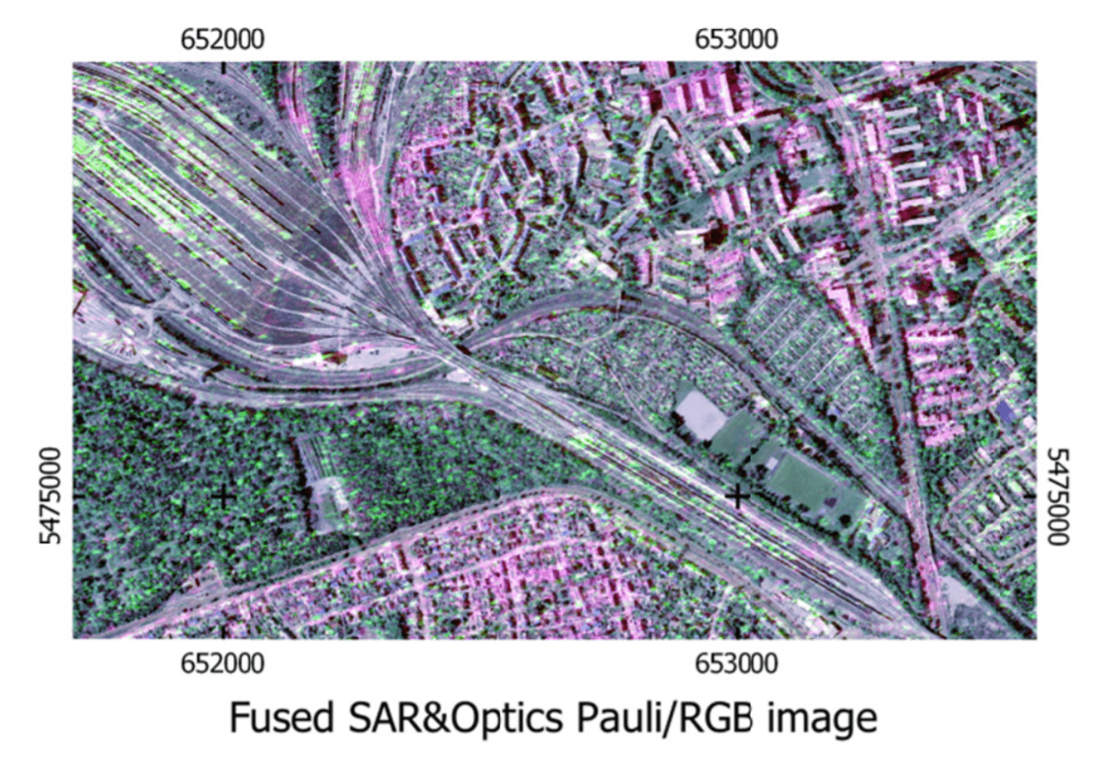
Researchers are also studying techniques to combine images from SAR and optical sensors with different features to enhance image clarity.
By combining the information from both types of images, a more informative and sharper image can be obtained.
References:
SAR-Sharpened Image of Kuwait, Iraq and Iran – June 18th, 2011
SAR-SHARPENING IN THE KENNAUGH FRAMEWORK
APPLIED TO THE FUSION OF MULTI-MODAL SAR AND OPTICAL IMAGES
(f) Colorization of SAR Images
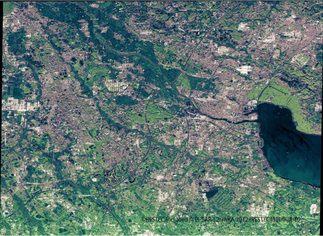
Efforts have been made to colourize SAR images, which may seem unclear at first glance, to resemble optical images.
Based on the surface properties obtained from SAR images (e.g., smooth, rough, etc.), objects are automatically categorized, and colors are assigned accordingly (e.g., “green” for forests, “blue” for water bodies).
References:
~世界初!だいちを彩る新技術 SAR画像をより身近に~ 陸域観測技術衛星2号「だいち2号」(ALOS-2)搭載LバンドSAR画像のカラー化技術について
(4) Representative SAR Satellites and Companies
Here are the introductions to some of the representative SAR satellites already launched into orbit:
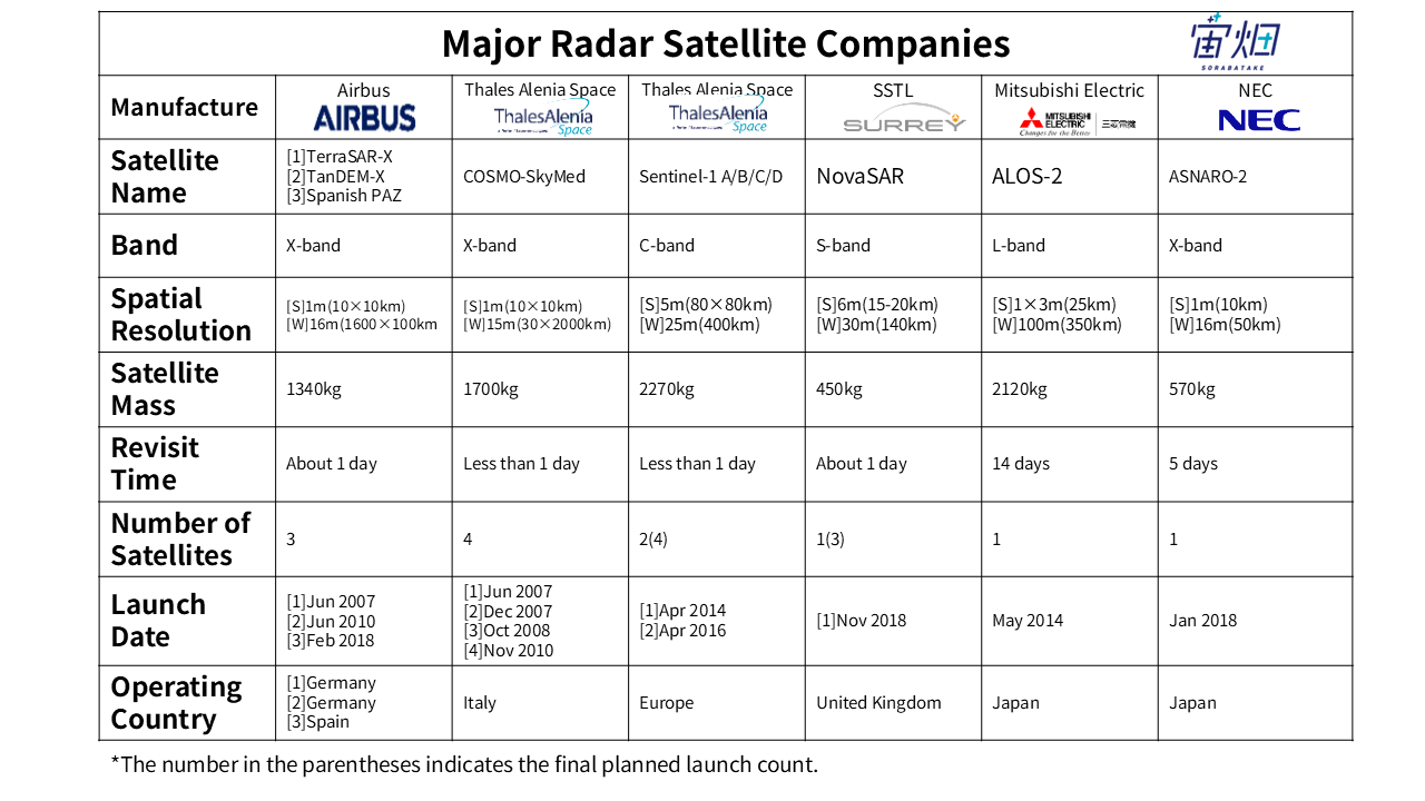
(a) Large Radar Satellite Companies:
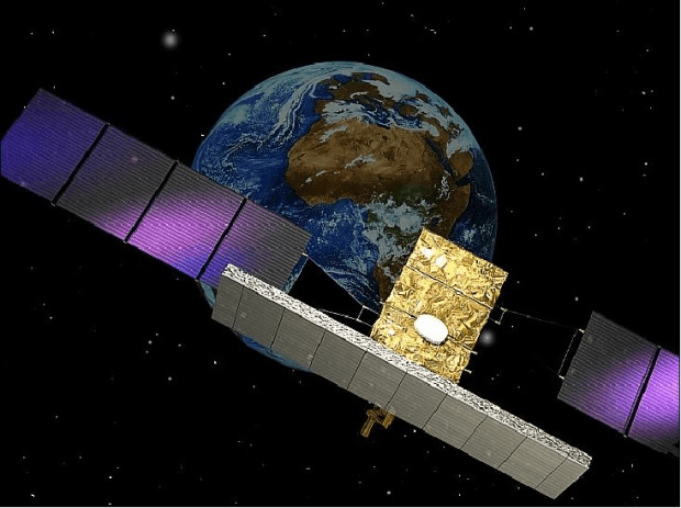
(i) TerraSAR-X/Tandem-X
TerraSAR-X and Tandem-X are SAR satellites commercialized by Germany.
TerraSAR-X was launched in 2007, and Tandem-X in 2010.
As the name “Tandem” suggests, the two satellites fly in close proximity to each other in the same orbit.
They employ an observation method where the leading satellite emits radar waves, and the trailing satellite receives them.
Among the commercially available SAR images, TerraSAR-X and Tandem-X provide the highest resolution of 1 meter. In comparison, Japan’s representative SAR satellite ALOS-2 offers approximately 3-meter resolution, and Canada’s RADARSAT-2 also provides around 3-meter resolution, placing them in the medium resolution category.
(ii) Cosmo-SkyMed
Italy’s SAR satellite is called COSMO-SkyMed. It operates with four satellites, enabling the observation of the same location within a few hours.
Alongside TerraSAR-X, COSMO-SkyMed provides the highest resolution SAR images commercially available, with a resolution of 1 meter.
(iii) Sentinel-1
Within the collaborative efforts of Europe, the Sentinel series includes a SAR satellite named Sentinel-1.
Its resolution is 5 meters, which is slightly lower than TerraSAR-X and COSMO-SkyMed’s 1-meter resolution. However, Sentinel-1 is known for its ability to capture wide-area images. Additionally, the images from Sentinel-1 are attractive because they are freely available for public use.
(b) SAR Satellites and Sensors in Japan:
Several SAR satellites have been launched in Japan.
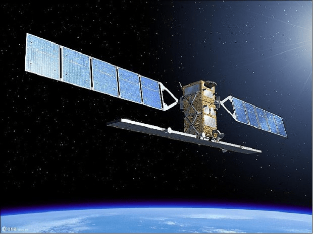
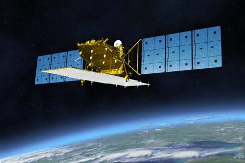
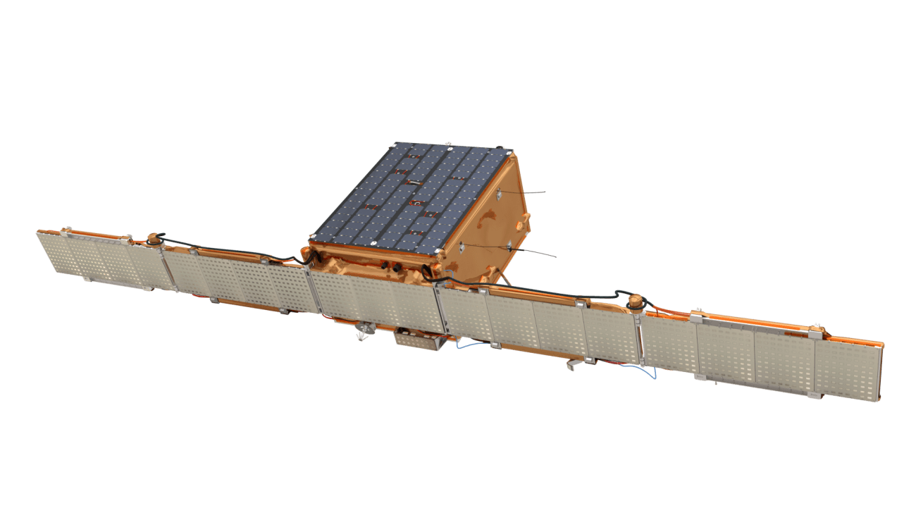
(i) Daichi (ALOS):
Credit : JAXA
Japan’s first SAR satellite was “fuyo 1 (JERS-1)”, and the subsequent one was “Daichi (ALOS)”.
Japan has been conducting observations using the L-band frequency, which has not been commonly used in Western countries. The L-band is well-suited for observing ground changes.
“Daichi” was launched in 2006 and ceased operation in 2011.
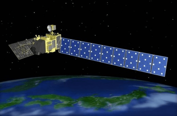
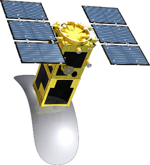
(ii) Daichi 2 (ALOS-2):
Credit : JAXA
“Daichi 2 (ALOS-2)” was developed as a successor to “Daichi” with improved resolution using the same L-band frequency.
It was launched in 2014 and continues to be in operation.
Reference:
だいち2号ソリューションブック 第3版
(iii) ASNARO-2
Japan’s commercially available SAR satellite, “ASNARO-2”, was launched in 2018.
It provides a resolution of 1 meter, comparable to the resolution of European TerraSAR-X and COSMO-SkyMed, while being a lightweight and high-performance satellite.
(c) Small SAR Satellites:
SAR satellites require significant power due to their active radar transmission, making it challenging to miniaturize them. However, recent technological advancements and focusing on specific imaging functions have led to successful miniaturization by some companies.
By reducing the size, the cost of SAR satellites also decreases, allowing for the launch of numerous SAR satellites and increasing the frequency of observations.
(i) NovaSAR-S

https://www.bbc.com/news/science-environment-46312874 Credit : SSTL
“NovaSAR-S” is a SAR satellite developed by SSTL, a well-known British small satellite manufacturer.
It uses the S-band frequency, which is not commonly used in other satellites.
NovaSAR-S was launched in 2018 and has been conducting observations since then.
(ii) ICEYE
ICEYE, a Finnish company, is a prominent developer of new small SAR satellites. In January 2018, they launched their first satellite, followed by a second one in December of the same year.
SAR satellites were previously considered to require significant time for image tuning. However, ICEYE’s second satellite achieved groundbreaking progress, releasing its initial images just four days after launch.
(5) Promising Aspects of SAR Imagery
In the field of Earth observation, the use of easily understandable optical images has been prevalent. Recent developments in the “New Space” sector, characterized by the entry of new startups, have focused on utilizing constellations of small satellites to capture optical images and integrate satellite imagery as part of big data in various businesses.
However, when optical images started to be made available, a significant challenge emerged: many areas were frequently covered by clouds, making it difficult to acquire a sufficient amount of data to be treated as big data.
One potential solution lies in SAR imagery, which can capture images even in cloudy or nighttime conditions, offering the ability to overcome the challenges faced by optical imagery.
However, SAR images have their own set of challenges. Compared to optical images, SAR images may not be as intuitive and easy to interpret, leaving room for improvement before practical applications become more widespread.
To overcome these technical barriers, a new and distinct approach that has been gaining attention is the application of machine learning to SAR image analysis. As this technology continues to evolve, SAR images are expected to become more user-friendly and accessible in the future.
Acknowledgments:
Special thanks to the individuals at RESTEC, Mr. Mukaida and Mr. Nagan for their cooperation in creating this article.
