Illegal logging in the Amazon continues to be uncovered! JICA’s incredible satellite system protects forests in 77countries
The "Japan International Cooperation Agency (JICA)" joined up with the Japan Aerospace Exploration Agency (JAXA) in 2016 to develop a system that keeps surveillance of illegal deforestation, an increasingly severe problem around the world.
The “Japan International Cooperation Agency (JICA)” has approximately 90 locations around the world cooperating with over 150 developing countries. In 2016, JICA teamed up with the Japan Aerospace Exploration Agency (JAXA) to actively pursue and develop space technology.
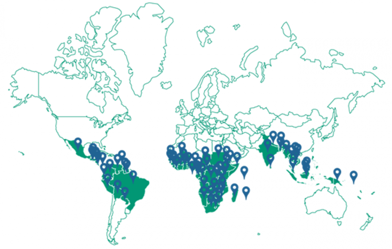
Together with JAXA, in 2016 JICA developed a surveillance system for the illegal logging of forests, an increasingly severe problem around the world. They are capable of globally observing forests in over 77 countries. This edition of Sorabatake takes a look at the current system along with a new system that JICA plans to release in the future.
JICA's mission! Protect dense forest of the Amazon from illegal logging.
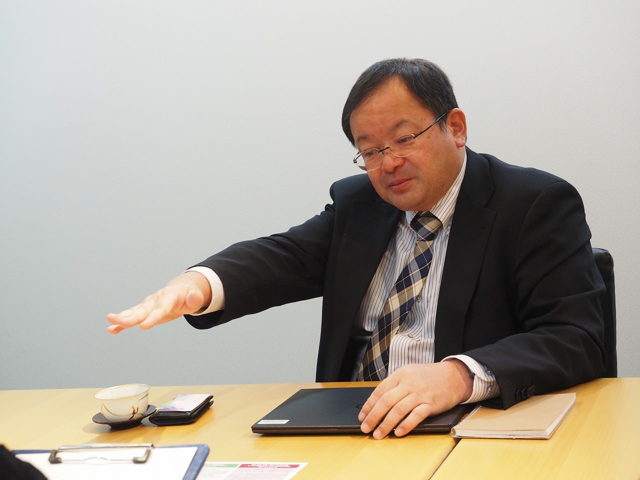
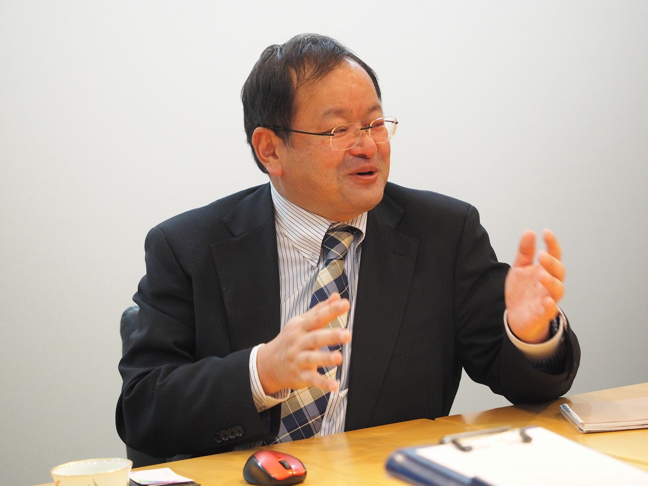
“Save the forests!” This is something that you have probably heard before, but why exactly is it that forests receive this much attention? We decided to ask this question to Kenichi Shishido, who has worked on protecting forests for a long time as a senior director general for the Japan International Cooperation Agency (JICA below).
Mr. Shishido:
The carbon dioxide created as a result of our breathing is called “greenhouse gas”. This is because this gas heats up the earth as it accumulates around it. Too much greenhouse gas is said to be the cause of global warming. It is maintained that one of the largest factors to impact the build-up of greenhouse gas (Co2) is “changes in vegetation on the earth’s surface”, in other words, that the number of forests has decreased.
Carbon dioxide is created when we burn fossil fuels (such as gasoline), but it is believed that if we are able to protect the unintentional depletion of the earth’s forests, this could have the same effect as placing limits on the emission of CO2 by fossil fuels.
Mr. Shishido: Right now, there is a growing effort for the international community to provide financial incentives to developing countries as thanks for protecting their lush forests around the world. This is called the “REDD+” project.
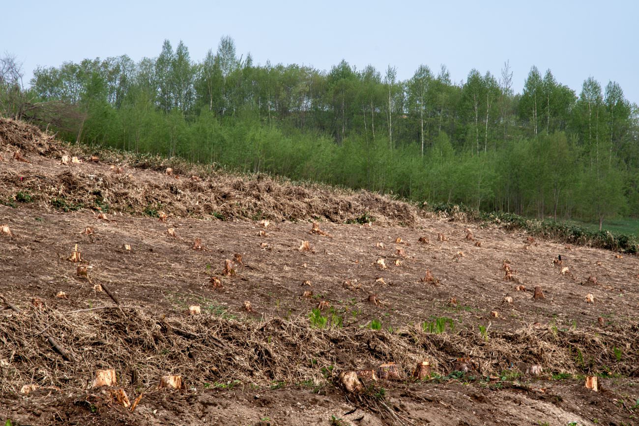
From around 2013, developing countries made a valiant effort to protect their forests, but it didn’t stop the reduction of their forests. The primary reason for this was that illegal logging was still happening, hidden deep within the dense forests. It is said that in Brazil, which is home to the expansive Amazon, a bad year would see over 20,000 square kilometers in deforestation. That is enough area to cover Japan four times.
Mr. Shishido: Brazil, worried about deforestation, needed watchful eyes to guard her forests. To answer this call, we set out on a journey to create “eyes in space” with the Japan Aerospace Exploration Agency (JAXA below). The system we developed to protect Brazil and beyond is the “JJ-FAST (JICA-JAXA Forest Early Warning System in the Tropics)“.
What makes the system capable of finding areas falling victim to deforestation.
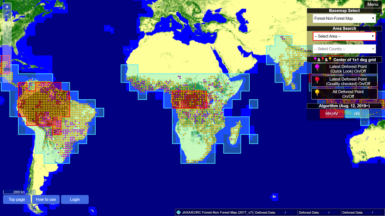
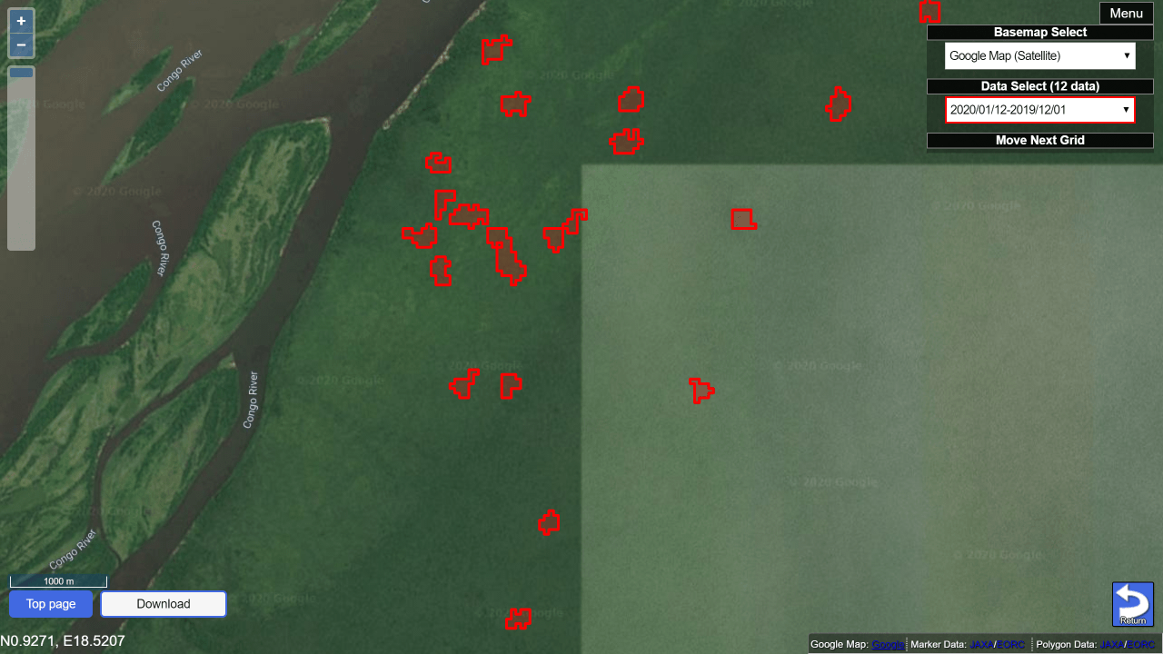
It can be used not just on the computer, but on smartphones as well. Source : https://www.eorc.jaxa.jp/jjfast/jj_mapmonitor_phase1.html
Mr. Shishido: This is a map that shows data gathered from the satellites. On the map, data is displayed on 111 square kilometer grids. Do you see a round pin on each of the grids?
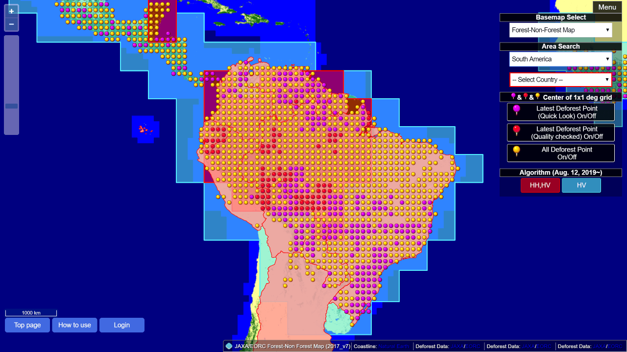
Mr. Shishido: If there is a sudden change, then the pin turns red. It shows if there is no longer a forest where a forest used to be, in other points on the map where logging has happened. If we zoom in a little bit more…
Sorabatake Memo: What is a SAR image?
AALOS-2’s SAR (Synthetic-Aperture Radar) observes waves at the L-band frequency. SAR is a radar image that uses a type of radio wave called a microwave. It can observe through night, clouds and smoke which can’t be detected with visible light, making it easy to observe illegal logging.
This is why satellites are incredible! The area covered by the system extends to a whopping 77 countries.
For weather satellites, it is especially difficult to observe the Amazon during the rainy season when thick clouds cover the area. Illegal loggers used this as a chance to log during rain when their activities are hidden. However, SAR images can be used to monitor the Amazon by seeing through the clouds
Through using this system, officers from environmental organizations have been able to go straight to the scene of the crime, and arrest or fine illegal loggers, resulting in over 40,000 cases being detected, and an 80% drop in trees lost to illegal logging.
Mr. Shishido: Following our success in Brazil, we received requests from neighboring countries such as Peru and Venezuela to implement this system. Satellites can take pictures of a large area, so as long as we can process the image, it is possible for us to provide our service to countries around Brazil as well.
That being said, we thought it would be hard to only choose countries that come to us, and developing a system for each country isn’t very efficient. So we decided to make our service public by releasing it to 77 countries that have large forests. In addition to not having the personnel, organizations in charge of protecting forests in most developing countries suffer from corruption that cuts off their flow of information. If the images are made public, NGO’s and the citizens of that country can see them. We have found, based on our data, that this has an effect on these kinds of problems. JICA doesn’t only provide the system, but they hold international conferences and conduct research for forest officials.
What a generous decision! By doing this, developing countries without budgets, personnel or infrastructure are able to easily monitor their forest.
And it looks like there is even more in store for next year. Just how are they going to improve the system?
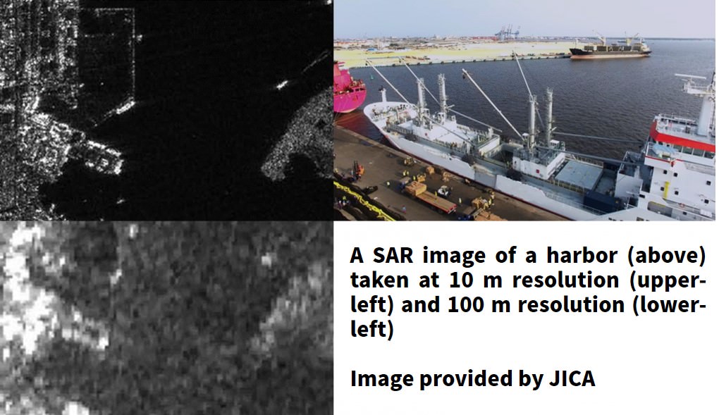
Mr. Shishido: Right now, with the “Daichi (ALOS) 2”, which we are using to observe, when observing at 50 m resolution, the most we can detect at once is 5 hectares.
After 2020, JAXA plans to launch “Daichi (ALOS) 4”, which will be able to detect deforestation in units of 1 hectare, with a resolution of 10 m. This is the level of resolution that has been sought after by each region for a long time. If we are able to make this happen, we will be able to see the earth’s surface even more clearly than before!
Loads of ideas for its uses outside deforestation too! What the future holds for activities conducted by the JJ combination.
As Japan’s advanced technology is used to help the world fight deforestation, the JJ combination made up by JICA and JAXA is currently developing new systems to help out in other genres such as fishing, agriculture, and infrastructure observation. Let’s ask about their plans in fishing first.
● For Fishing: Check on Suspicious Sea Activity, From Space!
Mr. Shishido: One point of concern for countries with seas, like Japan, is suspicious boats. We believe we may be able to stop foreign vessels such as smugglers and pirates that attack other ships by strengthening our watch on the sea from space.
In order to do this, first we need to improve our resolution. The only vessels that show up at 50 m resolution are big boats like cargo ships and battleships. He says they would prefer 10 m resolution to be able to find small fishing boats. But this problem can be solved by the new “Daichi (ALOS) 4” that the JJ-FAST is relying on to improve their activities.
Mr. Shishido: If surveillance at 10 m resolution is made possible, we will be able to see almost every ship at sea. The next issue is system development. We are currently putting our heads together to figure out how we can accurately identify suspicious ships.
However, there is a problem. We can only receive new information from our satellites in intervals of 14 to 41 days. And even then, it takes time for us to actually be able to see the pictures. Unlike deforestation, suspicious ships at sea will keep on moving. Due to this, even if we were to get information on suspicious ships, it will be difficult to pursue them in real time.
Mr. Shishido: We may not be able to directly stop them, but we will be able to take statistical data on when, where, and how many ships are operating. If we can grasp which areas see a lot of suspicious ships, we can create a patrol plan based on our data’s prediction. We would like to start our surveillance focusing on countries burdened with illegal operations, such as China, the Philippines, Vietnam, Indonesia, and more.
● For Agriculture: Check on Cultivated Area, From Space!
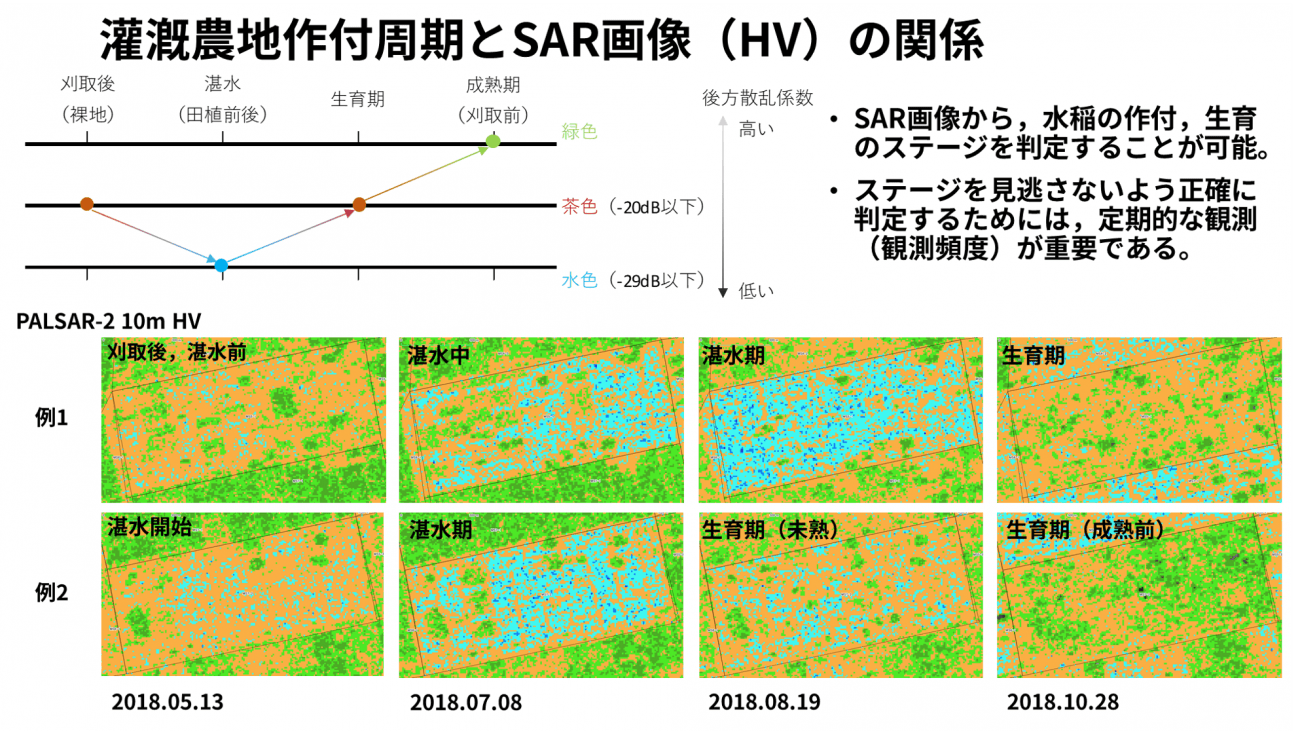
Mr. Shishido: JICA supports many fields, such as education and insurance, but one field that has an exceptionally good use for space technology is “agriculture”. This example is of our “Project for Supporting Rice Industry Development in Tanzania” project, where we used satellites to measure the area that could be used for rice production.
● For Infrastructure Observation: Check for Landslides on Mountain Roads, From Space!
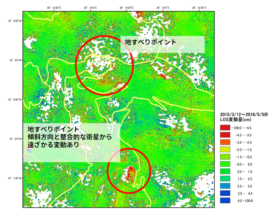
Mr. Shishido: Ethiopia’s mountains have constant large-scale landslides that sometimes destroy roads built for them. To fight this, we plan to use “Daichi (ALOS) 2” to periodically check on the same spots, and preemptively strengthen places where there is a high risk for landslides as a defensive measure. We hope that releasing this information will be useful to countries around the world, to help them manage their infrastructure-related maintenance and protect them against natural disasters.
Sorabatake Memo: Can you decipher ground conditions?
Due to the nature of satellites actively releasing electromagnetic waves and observing their reactions, when you look at the same spot taken by two different SAR images at different times, you can tell the difference between them without being affected by changes in the environment. Thanks to this, not only can we tell if there was a landslide, but we can catch changes in the strength of the ground as well.
Not only this, but if we capture the same spot from different angles, we can gather information on its altitude by looking at it from multiple dimensions. Daichi (ALOS) takes pictures of the entire earth’s surface at an altitude of 30 meters, at a vertical distance of 5 meters. The details can be seen here.
The 3 advantages to satellite data as seen by Senior Director General Shishido.
1. It can watch over a wide area.
Mr. Shishido: Just as we were able to bring the JICA-JAXA Forest Early Warning System in the Tropics “JJ-FAST” to 77 countries around the world, the uses for satellites can be applied globally. When there is a need to take data over a large area, satellites are thought of as the first solution. Their ability to watch over the entire world at a low cost is one of satellites strong points.
2. If you can create the system, it becomes automated.
Mr. Shishido: At first, it is a challenge to develop a program because you have to decide what kind of data will be recorded and how the data will be processed. But once you have that out of the way, it is typically all automated from then on. After you succeed in making it automated, running costs are very low.
For example, the JICA-JAXA Forest Early Warning System in the Tropics “JJ-FAST” only costs about twice of our Vietnam project to cover the entire world.
3. The value is in the ideas! Limitless Possibilities
Mr. Shishido: A lot of satellite data can be used for free. so depending on how you set it up there are many applications that can be of use. Before, when we held an open innovation event with JAXA, we invited the private sector and talented engineers, and there were many valuable ideas about observing forest fires and coral reefs. I felt that when it came to the use of satellites, how much they can be used to better society, the possibilities were limitless.
New ideas are "always welcome"!
urrently JICA is putting resources into educating people on how satellite data can be used for foreign aid, and creating an environment for foreign exchange students in Japan to learn about space technology, including satellites.
It is pretty exciting stuff for Japan’s advanced space technology to spread its wings and be useful around the world. However, when it comes to using satellite data, a lot of it requires a specialist or researcher to decipher what it actually means, so it isn’t exactly user friendly.
Mr. Shishido:Particularly, when it comes to the “DAICHI (ALOS)” series that we are using, we believe that there are still a variety of fields that they can be used for achieving SDGs, but the fact of the matter is, many developing countries don’t have the budget or personnel to use them to their full potential. This is especially true for poorer developing countries.
That is precisely why we aim to create a system that fishermen and loggers in even third world countries can use for free to easily observe information from just a glance on their smartphone. And we hope that with the needs born from this, that the private sector will also take part in this with us.
In order to make that happen, it is important to get the cooperation from businessmen and specialists who have new ideas. If there is someone whose ideals fall in line with ours, we would love to work together and make ideas that help out the world real.
Editor’s Notes
The scale of watching over countries from around the entire world that suffer from illegal logging is something only satellites are capable of handling. SAR satellites even clear the challenge of being able to see the earth’s surface through thick clouds that illegal loggers have been using to dodge surveillance from the sky! It looks like the “JJ-FAST” uses all of the strong points a satellite has to offer. And it sounds like the new 3 and 4 versions of the “Daichi (ALOS) 2” will be up in the air soon. We look forward to it.