This is the forefront of the SAR image! Viewing images taken by ICEYE on Tellus!
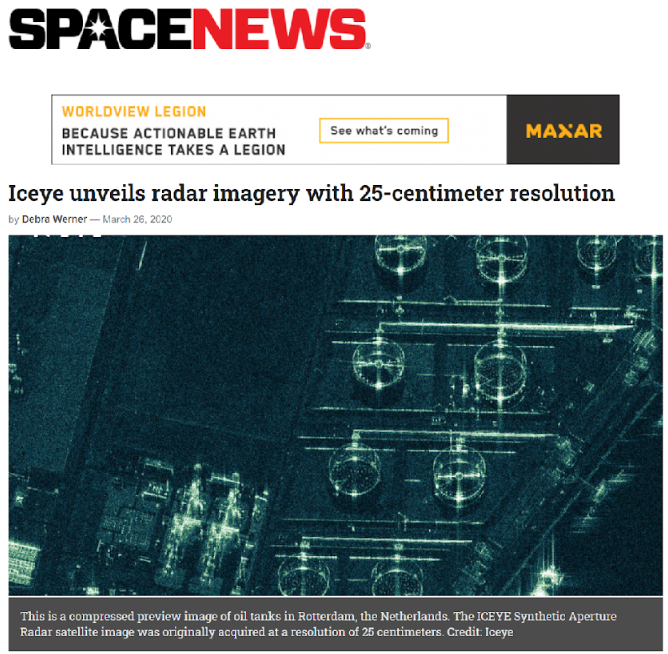
One of the big up and coming technologies in the space industry right now is SAR (synthetic-aperture radar), and the global company on the forefront of this technology is a company stationed in Finland called ICEYE. This company recently made headlines when they achieved a SAR resolution of 25 cm.
One of the big up and coming technologies in the space industry right now is SAR (synthetic-aperture radar), and the global company on the forefront of this technology is a company stationed in Finland called ICEYE.
This company recently made headlines when they achieved a SAR resolution of 25 cm.
When it comes to resolution, SAR images are generally considered inferior to optical images, which is why this feat is garnishing so much attention.
That being said, as ICEYE is a private start up, its photos aren’t available to the public for free. Many have yet to see just how high the resolution for these photos is, and how useful they could be?
But that won’t be the case as of today! As if to answer the public’s wishes, ICEYE recently released a plethora of sample images to the public!
So in today’s article, we will pick out a few of those images and upload them to Tellus! Not only that, but we will be looking at the same spots using different SAR images (taken by ALOS-2) to compare and see just how good images taken by ICEYE really are.
We’ll also be making the codes we use available, so be sure to use them to access ICEYE’s images yourself!
(Caution) In this article, we are downloading data taken by ICEYE and uploading it to Tellus. Please understand that you will not be able to access the images via Tellus’ API.
Let's learn the basics about ICEYE!
To start off, let’s take this opportunity to explain a little bit about what kind of company ICEYE is. ICEYE has actually been the subject of many of our articles, but this should be a good time to review what this company does.
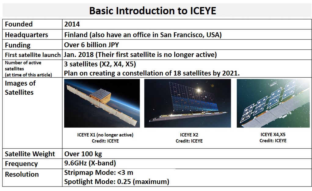
Also, try taking a look at the satellite itself. You can tell it has changed a lot since its first model. The way they have been able to make quick upgrades to their satellite really shows a true start-up spirit.
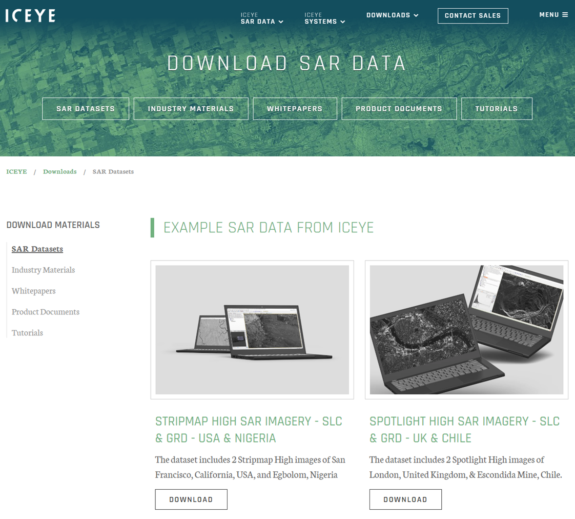
Let's download some sample images off the ICEYE homepage!
Alright, now we will acquire the images. You can download them using the following steps.
① Access their home page at https://www.iceye.com/downloads/datasets
This is where we download their data on Japan.

② Fill in the form.
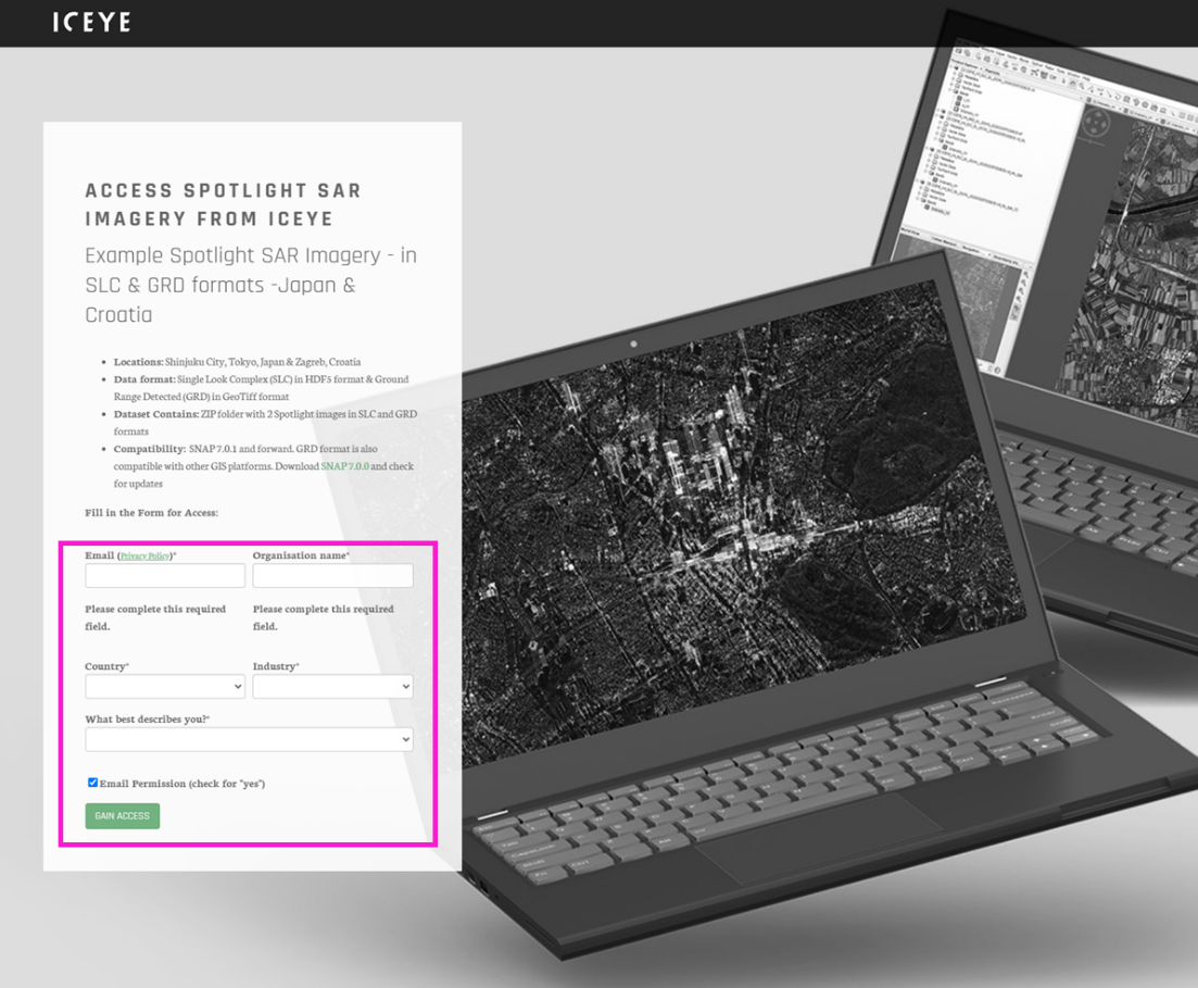
(You don’t need to confirm via email after you fill in the form, and will be given instant access.)
③ Click the download link (this should download a ZIP file.)
And that is all you need to do to download their sample images. Pretty easy, right?
Let’s check out what kind of images were downloaded.
Let's upload the images to Tellus and check them out!
In order to view the file and process its images, you will need to use some kind of GIS application. There is a compatible software developed by ESA called SNAP available on ICEYE’s homepage, but we would like to try to process the data directly on Japan’s satellite data platform, Tellus.
This is also really easy to do. We’ll use the following steps.
① Upload to Tellus by dragging and dropping the file.
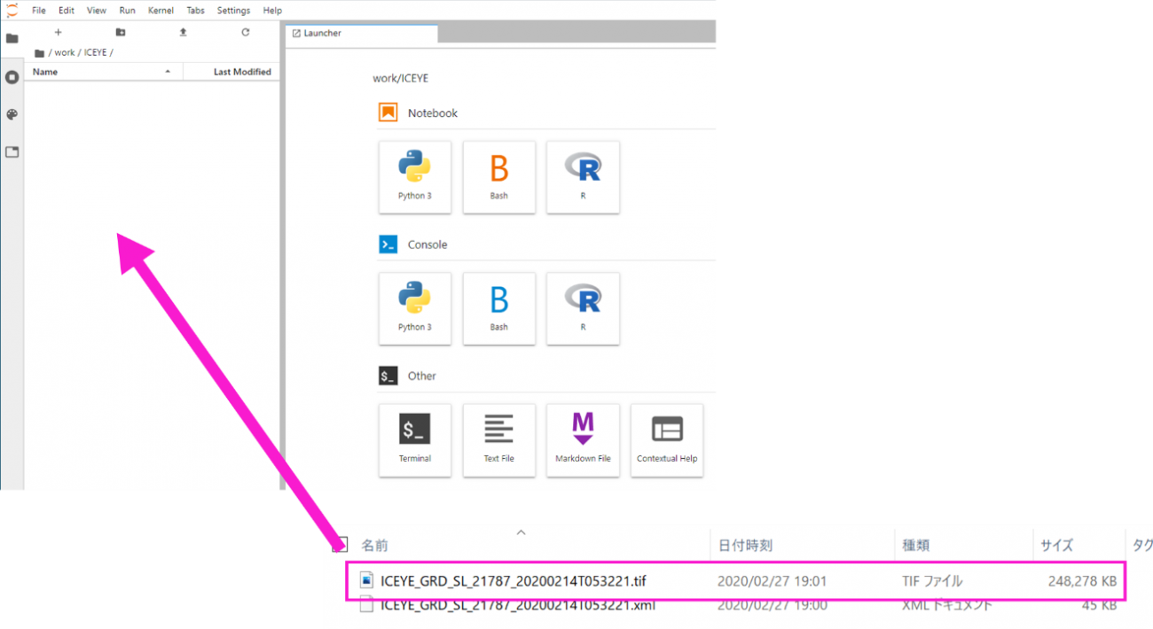
The file is only 250 MB, so it shouldn’t take that long.
Just a side-note; the standard data from ALOS-2 is about 7 GB, and requires a specialized server for smooth use. For future projects, it would be nice if they could make the files smaller and easier to use.
② Import the Tif file and convert it to images
from osgeo import gdal, gdalconst, gdal_array
import os
%matplotlib inline
import numpy as np
import matplotlib.pyplot as plt

offx = 0
offy = 0
cols = 100
rows = 100

tif = gdal.Open(os.path.join('.','ICEYE_GRD_SL_21787_20200214T053221.tif'), gdalconst.GA_ReadOnly)
img = tif.GetRasterBand(1).ReadAsArray(offx, offy, cols, rows)
img = np.flipud(img)

plt.figure()
plt.imshow(img,cmap='gray', vmin = 0, vmax = 255, interpolation = 'none')
plt.imsave('sample.png', img,cmap='gray', vmin = 0, vmax = 255)
Below is what you should get.
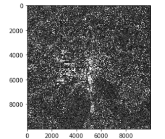
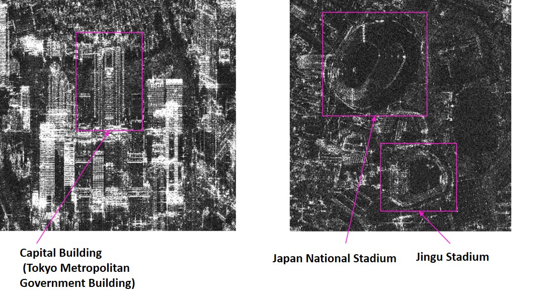
This doesn’t really paint a clear picture, so let’s try opening up one of the saved images.
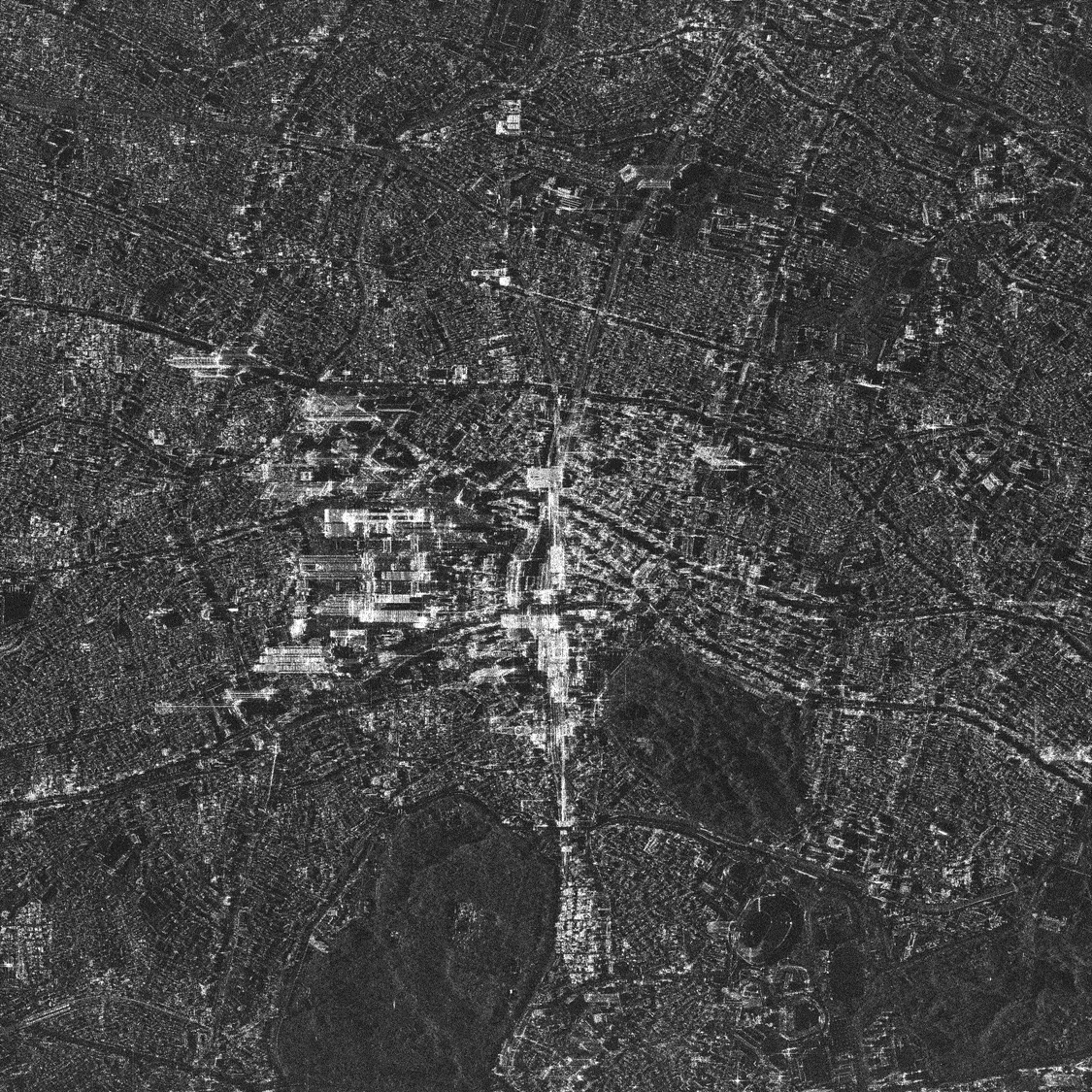
Looks pretty good! You can clearly see the capital building and the Japan National Stadium around Shinjuku Station.
Let's look at all the different sample images!
Now we will introduce other photos using the sample code above.
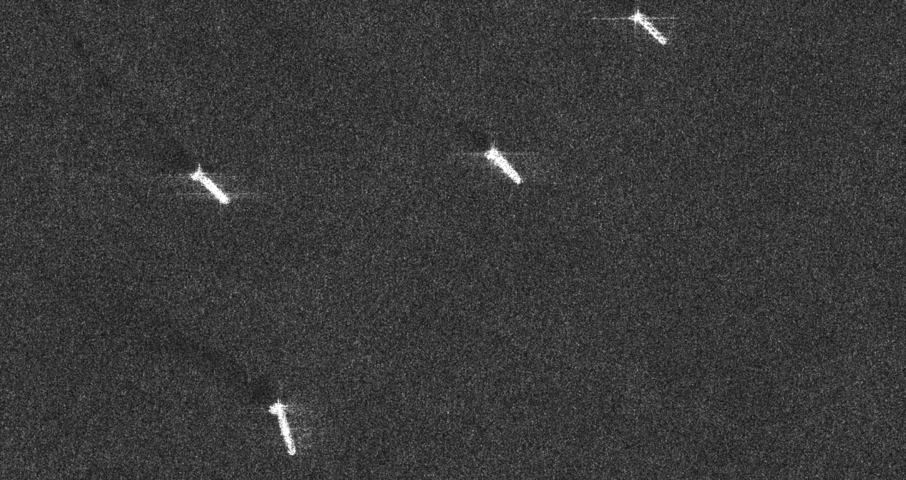
◇ Changi Airport (Singapore)
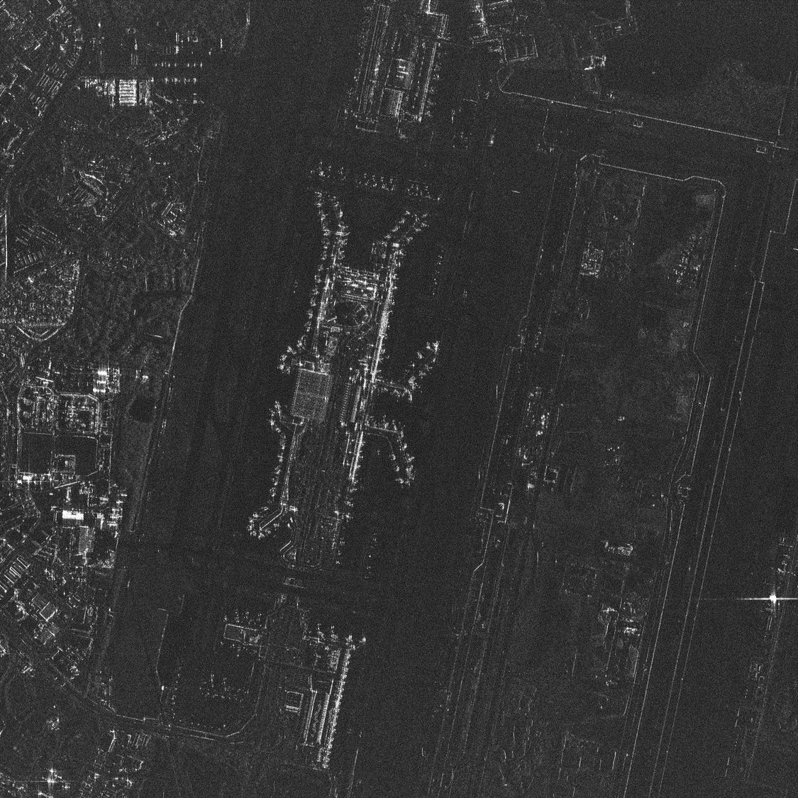
Airports are one of the main entities that make use of satellite surveillance, and this looks incredible for a SAR image. Whilst you can’t tell what kind of aircraft they are, if we zoom in you can count how many of them are at the terminal.
◇ Athens (Greece)
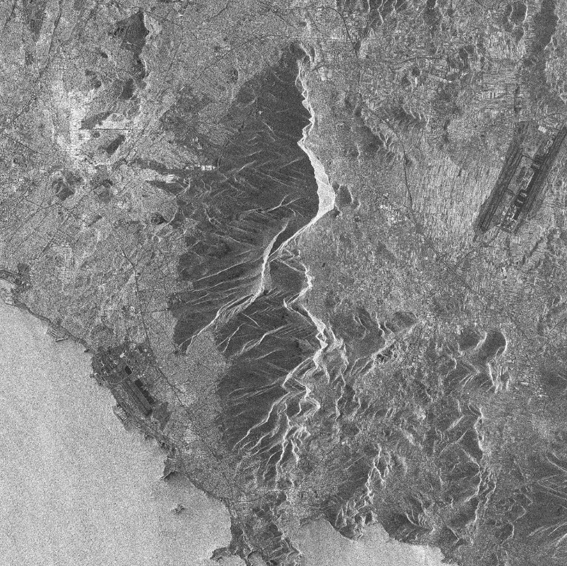
The rugged mountain range looks beautiful. Let’s zoom into the middle of the mountain.
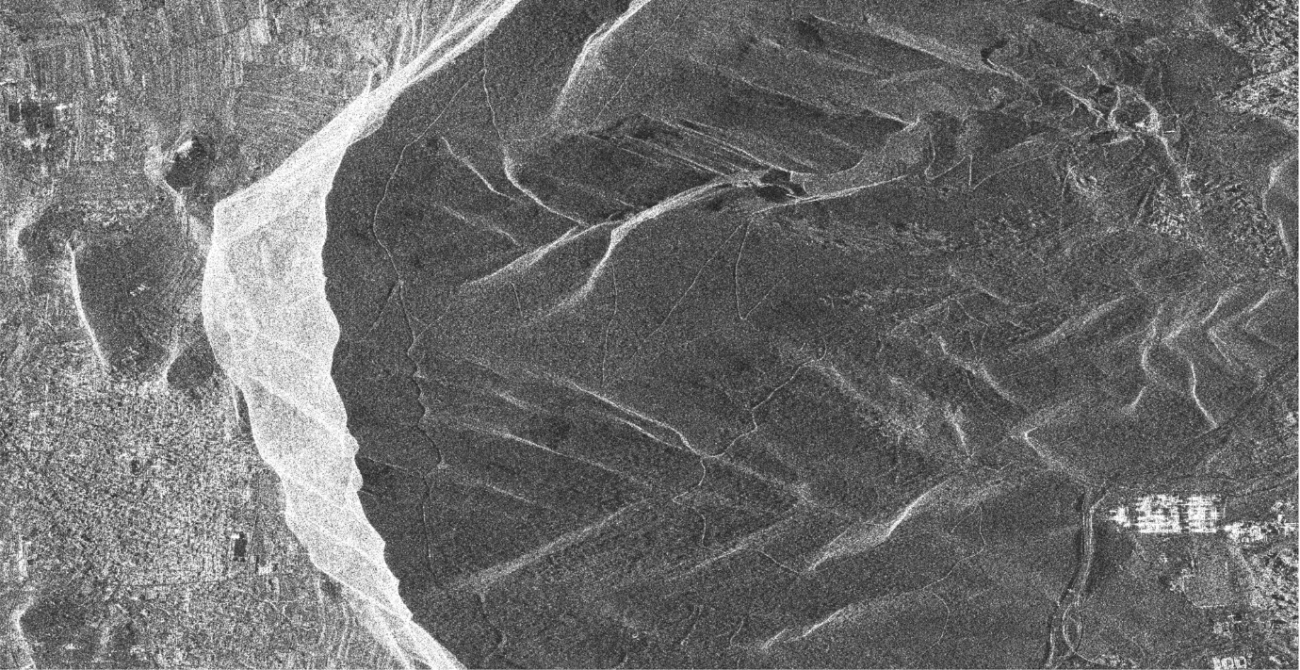
You can easily make out the path running through the mountain. This could be used to monitor tourism and natural disasters.
◇ The Suez Canal (Egypt)
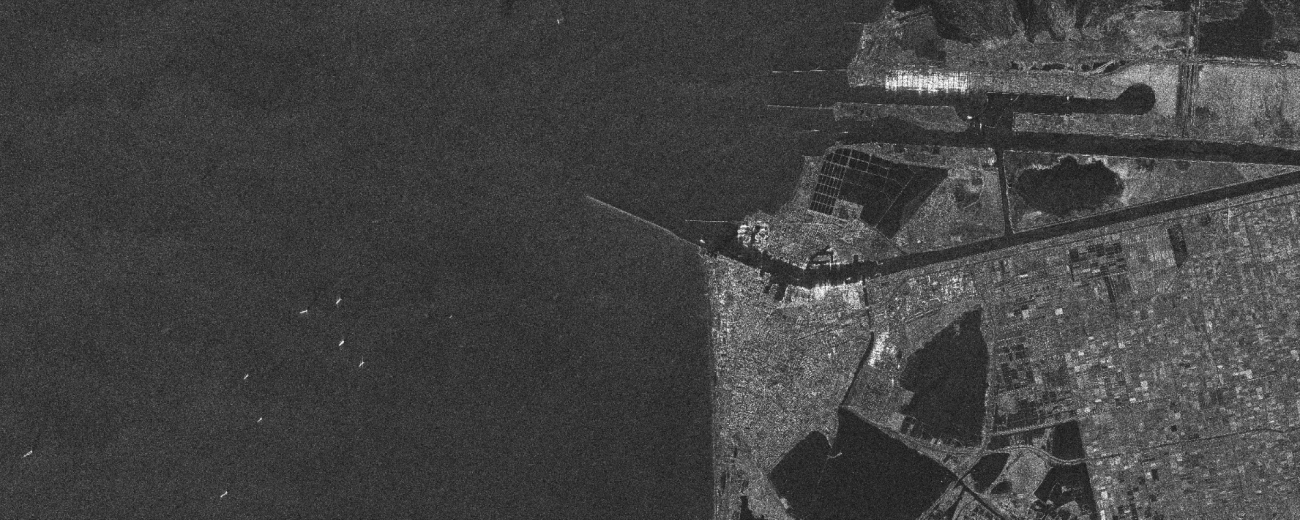
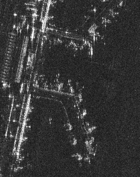
You can see boats on the Suez Canal, one of the world’s core shipping routes. Let’s try zooming in on some of the boats gathered out at sea.
As you can see, the images are very clear. This isn’t enough to make out what kind of boats they are, but if you look closely you can see the waves that trail behind them, which could be used for analyzing the boat’s speed and direction.
Let's compare them with Japanese SAR images!
Now that we have seen images taken by ICEYE, it’s time to compare them with Japanese SAR images to see how they are different.
Tellus currently uses SAR images provided by ALOS-2 (developed by JAXA) and ASNARO-2 (developed by NEC).
Data for ALOS-2 uses the product ID (ALOS2275312860-190629) shown in this article.
Imaging PALSAR-2 L1.1 using Tellus [with code]
Based on this article, the data taken by ASNARO-2 is a combination of multiple images centered around Shinjuku.
[How to Use Tellus from Scratch] How do you get an image larger than a map tile? Four tips on handling map tiles
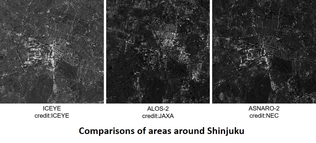
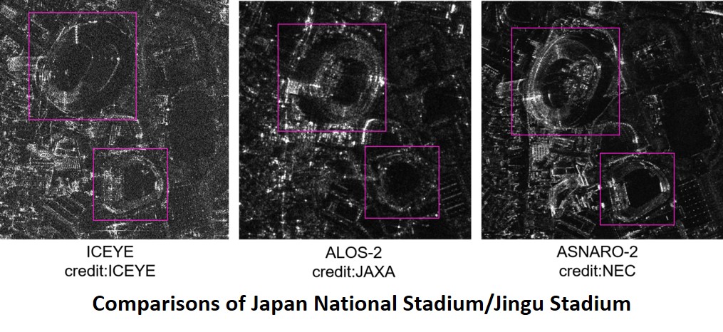
Due to the two satellites taking pictures at different angles, it won’t be a perfect comparison, but it looks like ICEYE’s higher resolution allows us to distinguish different floors on each of the buildings
Which is more amazing? ICEYE or ALOS-2?
Incidentally, it is interesting that the ICEYE, which is considered a small satellite, takes better photos than the ALOS-2, a much larger satellite. Let’s take a second to compare each of the satellites.
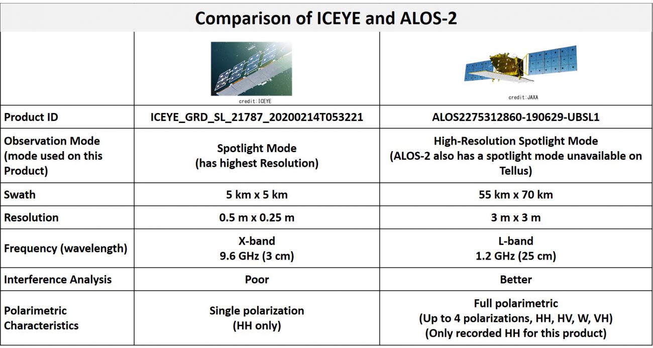
The key factor here is antenna size. Smaller antennas are capable of taking SAR photos at a higher-resolution, which means a small satellite can also take high-quality photos. For those who are interested why, we go into detail about antenna size here in this article.
Do Smaller Antenna Really Correlate With Higher Resolution? Thorough Examination of One of SAR’s Mysteries Without Using any Formulas!
Larger satellites, on the other hand, have the advantage when it comes to observing a wider range. Small satellites can close this gap by forming a constellation (a network of multiple satellites), which allows them to cover a larger area as well.
There are, however, disadvantages to using smaller satellites.
They aren't great at interface analysis.
Interface analysis takes two SAR images taken at different times to detect changes as small as a few centimeters in the earth’s surface. The electromagnetic waves used for making these observations rely on slight phase deviation, so the satellite has to remain perfectly stagnant between sending and receiving the waves. Smaller satellites tend to have less equipment for maintaining stability, making interface analysis a challenge.
The electromagnetic waves used by ICEYE fall on what is called the X-band of the frequency spectrum. X-band waves are shorter than the L-band waves used by ALOS-2, which makes them more susceptible to distortion due to the ionosphere and water vapour, and thus less suited for interface analysis.
They aren't great for analysis which uses polarization characteristics.
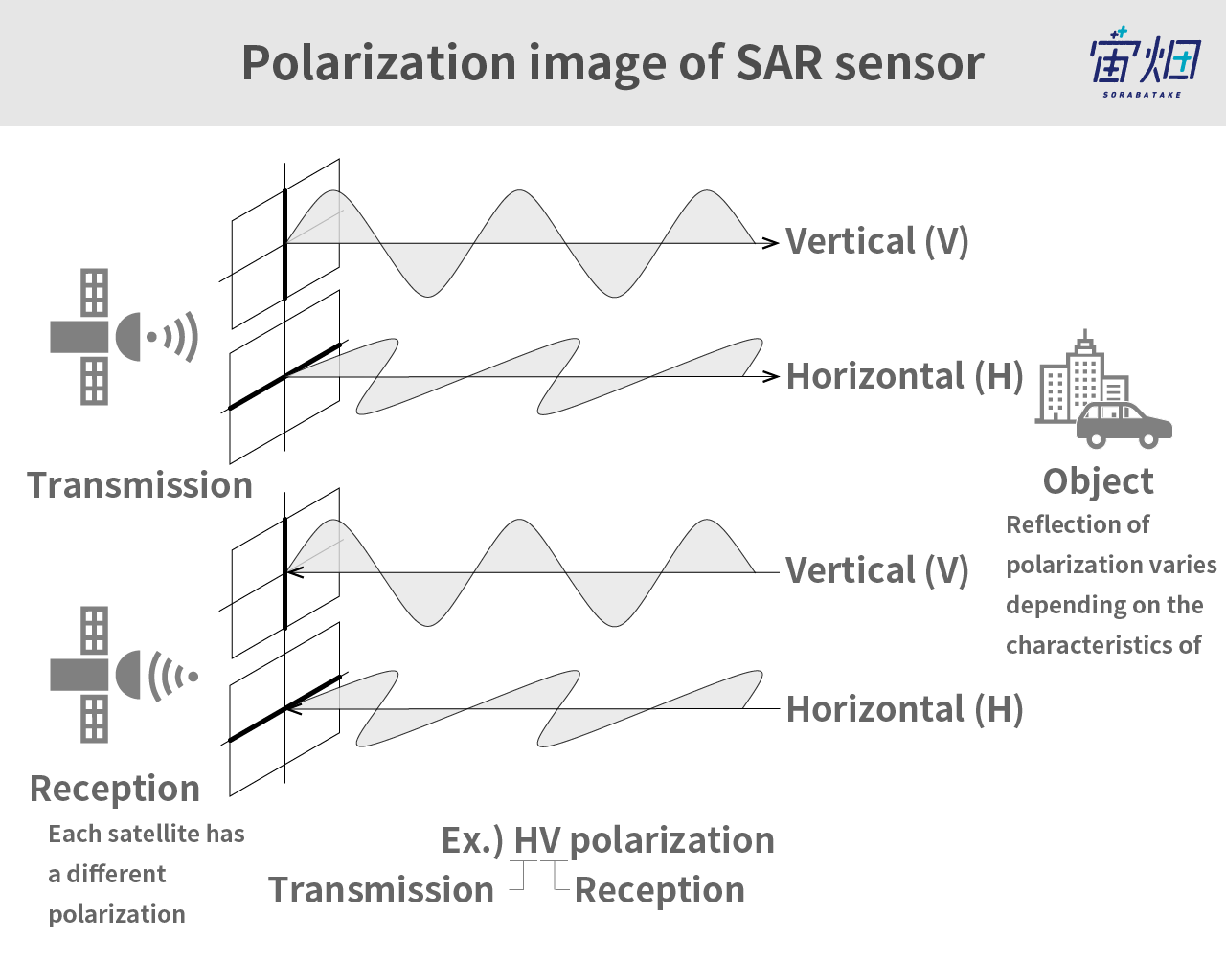
One of the features of SAR is polarization. To put it simply, depending on which direction the wave vibrates, you can distinguish waves by a combination of their transmission and submission.
At the moment, analysis based on polarization characteristics are easier to perform using larger satellites. Even though small satellites can technically perform this kind of analysis if they have the necessary equipment, most small satellites are only equipped with a single polarity.
This is why small SAR satellites that use X-band waves aren’t always better than the conventional large satellite. You need to use the satellite that suits the data you want to collect.
For those of you who want to learn more about interface and polarimetric analysis, we have articles on both techniques available here.
Using Tellus to Determine Land Subsidence via InSAR Analysis [Code Included]
Structural Classifications Using SAR Polarimetry (Polarimetric Decomposition)
But wait, there's more! ICEYE's Next Project: SAR Video
We’ll finish off by introducing an interesting business plan recently announced by ICEYE. Back in March 2020, they announced that they would be creating a video service that uses SAR. They released a promotional video about the project, so be sure to check that out.
In the video, you can clearly see cars, planes, and boats in motion.
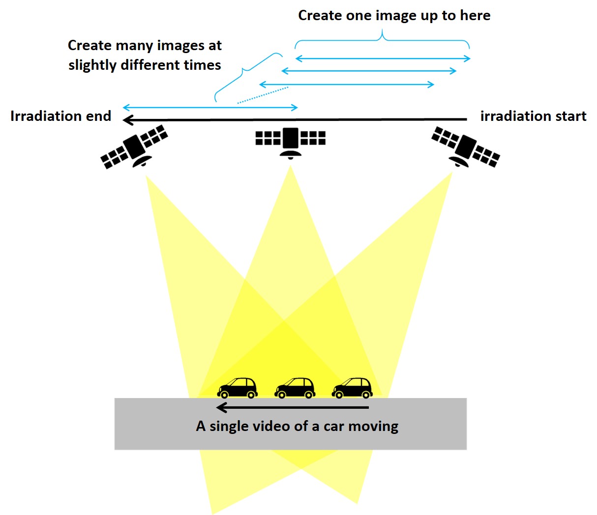
Some of you might be wondering how they are able to take videos using SAR, but it is actually quite easy.
SAR images are taken by sending electromagnetic waves to the same spot for 5 to 20 seconds. On ICEYE spotlight mode, it takes 20 seconds. You could use 10 seconds of these 20 seconds to create an image too, although it would result in a lower resolution.
To make a 10 second video, if you were to take multiple images at slightly different times (say, 600 pictures), you would end up with a 30 fps (600 pictures per 20 seconds) video.
Video technology for even optical satellites has seen progress in recent years, and there is valuable information, such as speed and vector, that stands to be gained from video data. ICEYE is likely paying attention to this trend. It looks like there is still a lot in store for SAR satellite surveillance technology.
Final Thoughts
So what do you think? This was a good opportunity to catch a glimpse of what ICEYE, a global leader in the SAR industry, is capable of.
Looking at sample images like we did in this article familiarized us with what ICEYE can and can’t do. We hope this was a good chance for our readers to have ideas about how they can use images taken by ICEYE for their own business and research.
We urge Japanese satellite companies to also actively publish sample data in order to gain more users.
We should mention that small SAR satellites that use X-band waves are gaining track in Japan as well, with top runners including companies like NEC (owner of ASNARO-2), start-ups such as Synspective, and the QPS research facility based in Kyushu. Their future endeavors are definitely not to be missed!
Images taken by ASNARO-2 are available to view on Tellus!
Try using satellite data on “Tellus”!
Want to try using satellite data? Try out Japan’s open and free to use data platform, “Tellus”!
You can register for Tellus right here
